Geographic Features, Landform Words & Topographic Map Activities – World Facts Packet Update!
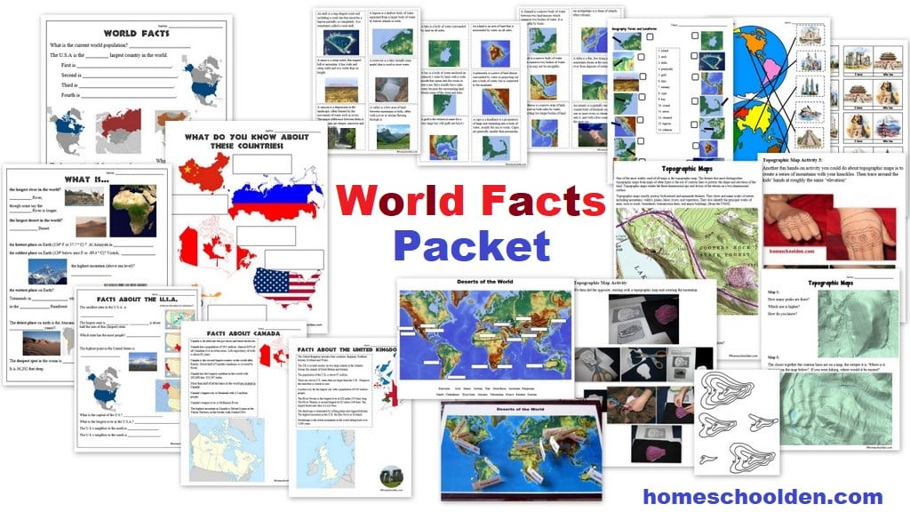
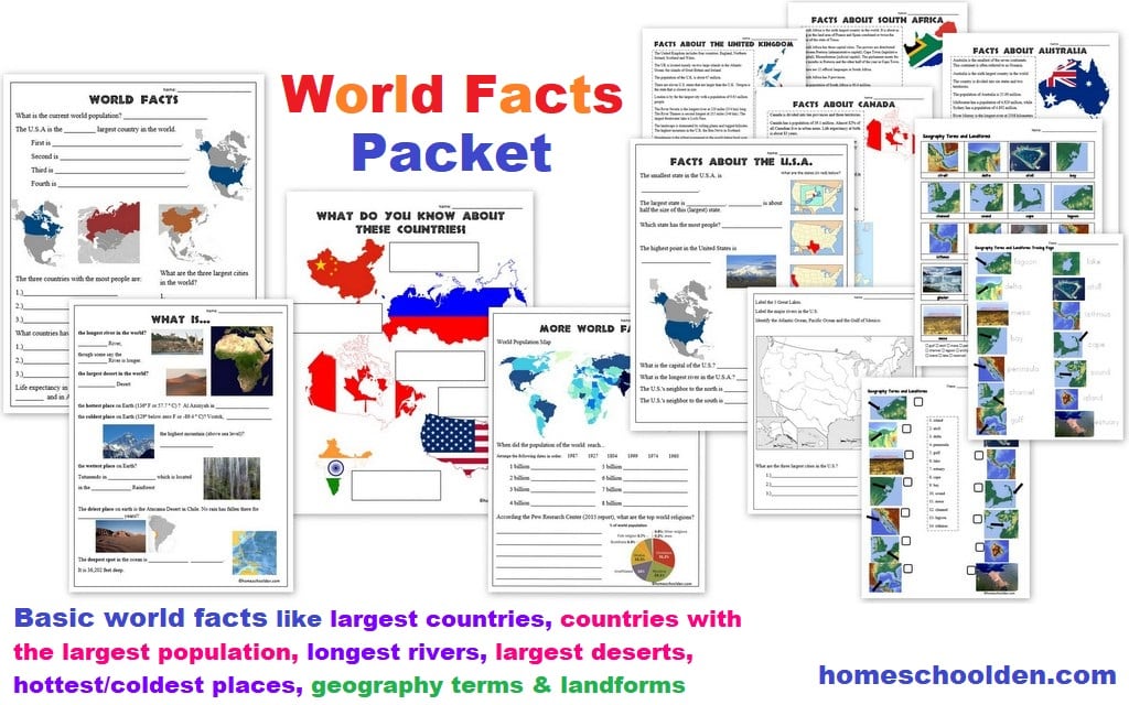 We do a lot of history units and basic geography in our homeschool, but I also want to cover some other social studies topics. Once every year or so, we add in this World Facts Unit. We go over some basic world facts, as well as geographic terms, landforms, the deserts of the world, some famous world landmarks, topographic maps, and more.
We cover…
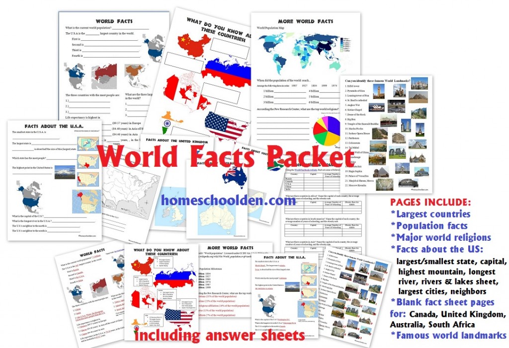
- What are the four largest countries? (Russia, Canada, the U.S.A., China)
- What countries have the most people? (China, India, the U.S.A.)
- What are the world’s largest cities? (Tokyo, Jakarta, Seoul)
- Which countries have the longest life expectancy? (Monaco, Macau, Japan)
- What are the major religions?
The packet has information about population growth. When did the world hit 1 billion, 2, billion, 3 billion… up to its current 7+billion population size? The kids have to sort the dates and will see how while we reached a population of 1 billion in 1804, we quickly grew from 4 billion (1974), 5 billion (1987), 6 billion (1999) and 7 billion in 2011 and 7.8 billion in 2021!
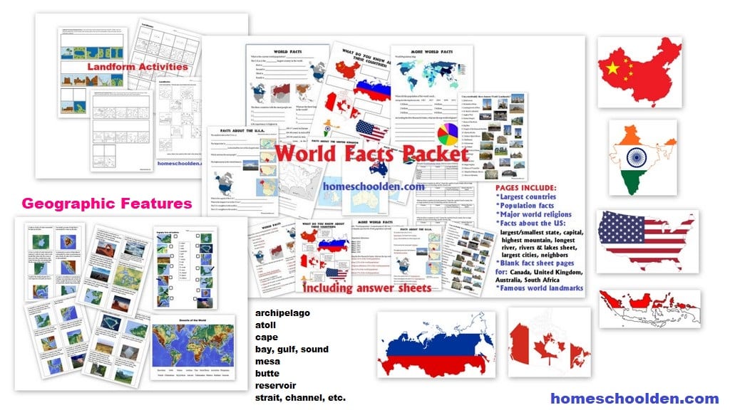
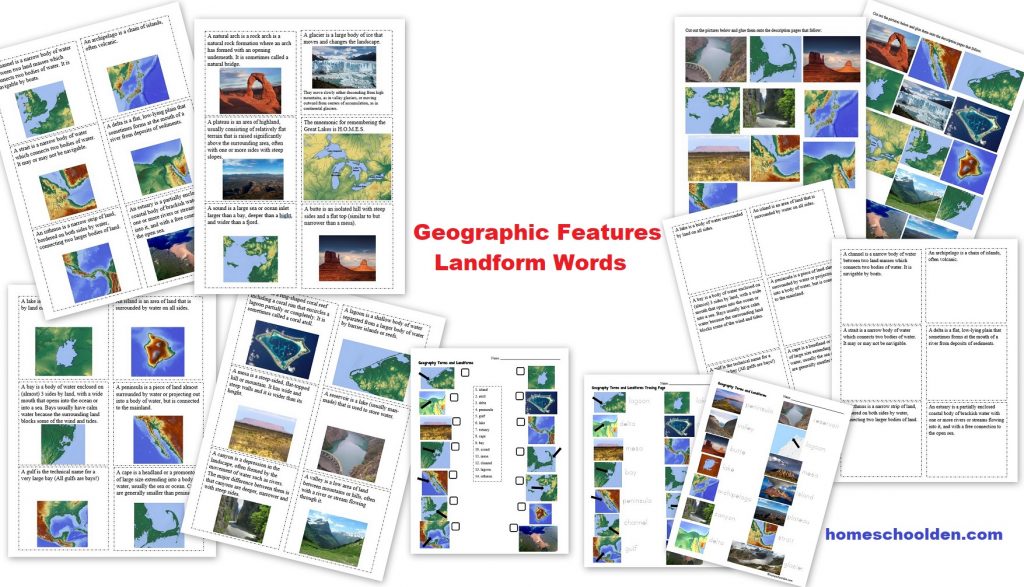
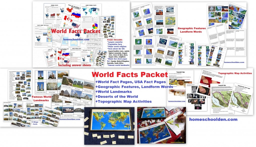
 This year, we are spending some time working on some geography skills again. I added an entirely new section into the World Facts Packet about geographic features and landforms (terms such as bay, gulf, sound, atoll, channel, strait, cape, mesa, butte and many more). In addition to working with physical maps, we’ll also do a number of activities about topographic maps. I also added in some fun activities to help learn about famous world landmarks.
In all, I have added nearly 50 pages to the World Facts packet, so it is now over 125 pages!!
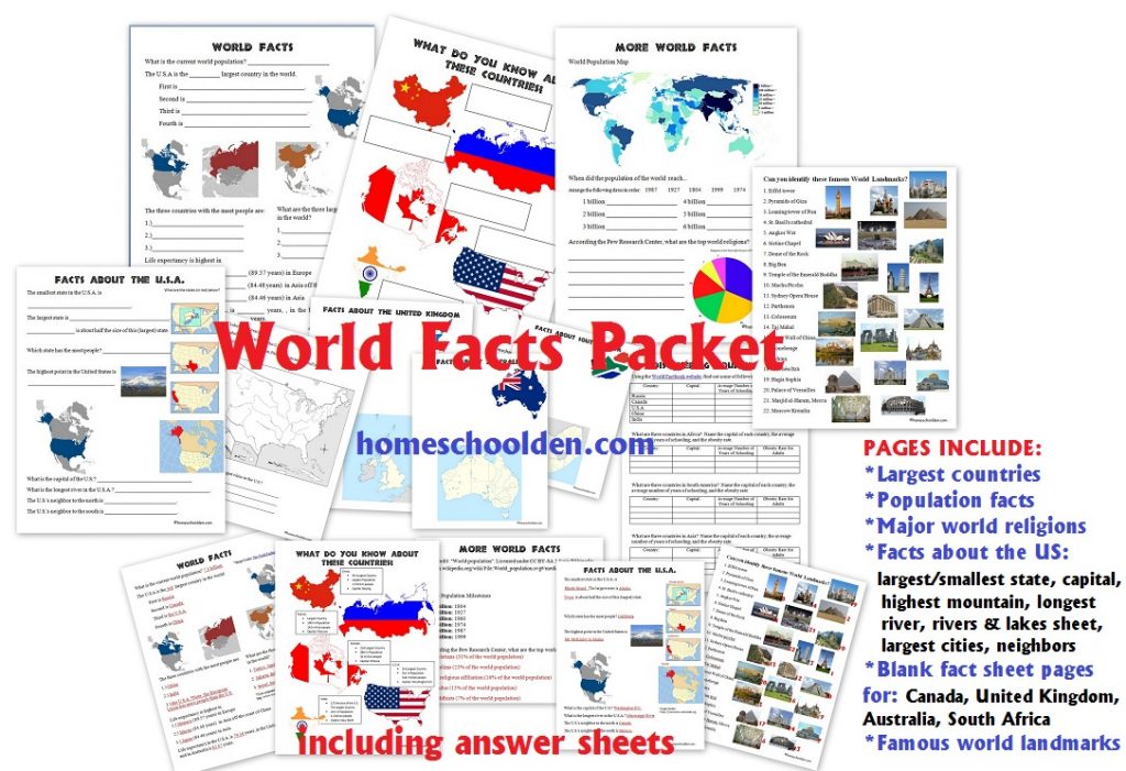
As many of you know, the first part of this packet focuses on basic world facts. We covered some of these topics:
- What are the largest countries? the countries with the largest populations? the largest cities?
- What is the longest river? tallest mountain? wettest place on earth? the deepest spot?
- One page that is really intriguing is when the world population reached 1 billion, 2 billion, 3 billion, 4 billion, 5 billion and 6 billion. The answers really shocked me!
- There is also a USA fact page (the largest and smallest states, the state with the largest population, the longest river, etc.)
- There is a USA river page
- There are some pages that can be used for student research.
Famous World Landmark: Montessori Cards, Worksheet, Bingo Cards
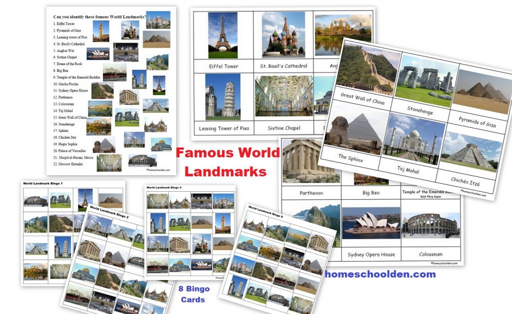
This section includes Montessori 3-part cards. These can also be used for a memory game.
(Place all the cards face-down. Try to find matching pairs with the picture and word cards.) It also includes a matching page. And, it includes 8 world landmark bingo cards (that have just been added to the packet!).
On the first day, we looked over all the world landmarks. The kids looked at their worksheet but did not fill in the answers (they just pointed with their fingers). The second day, we played bingo with the world landmark pictures. (I showed the picture card when they needed help.) On subsequent days we continued to review these (playing the bingo cards), I started to show the pictures less frequently.
We laminated the bingo cards and used a dry-erase marker to cross off the pictures as the landmark was called out.
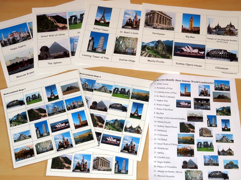 My kids really love puzzles and I thought I would also mention that after we spent time on the World Landmarks games and activities (see the picture above of the bingo games and matching page) I had them do a Ravensburger World Landmarks Puzzle. (affiliate link) If your kids like puzzles, you might want to check this one out!:
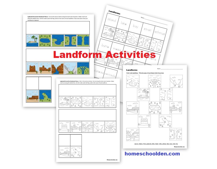
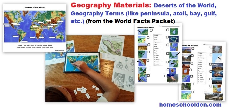
Geographic Features and Landform Words: Notebook pages, tracing pages (for younger kids), matching page
I wanted to be sure the kids also knew the various geographic features and landform vocabulary. Of course, they knew the basics like lakes, islands, peninsula but we also went over terms such as
- archipelago
- atoll
- cape
- bay, gulf, sound
- mesa
- butte
- reservoir
- strait, channel
- lagoon
and others.
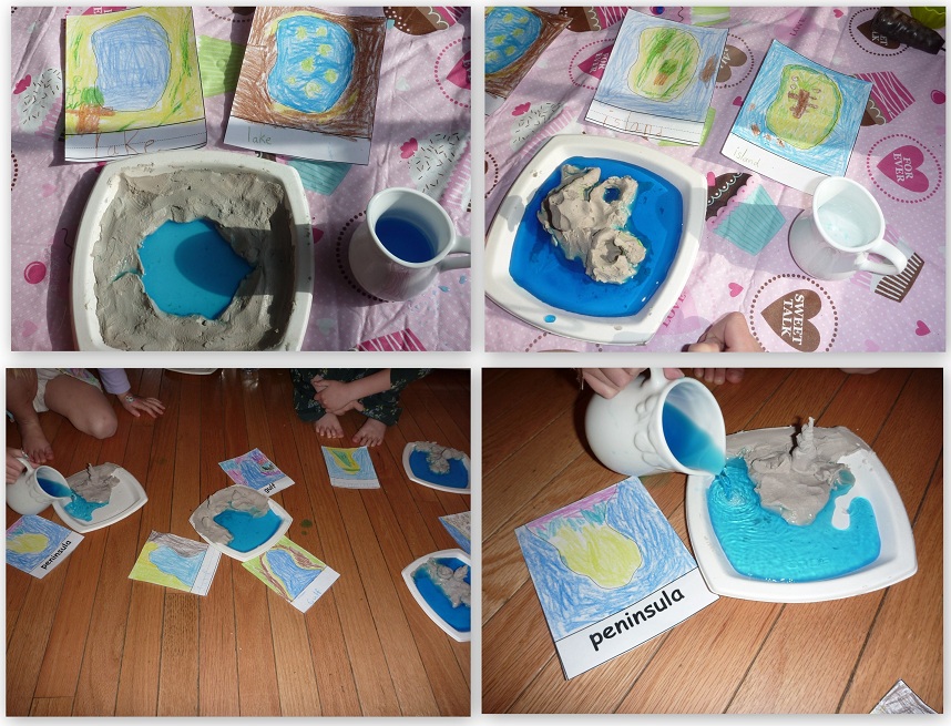
 If your kids are younger, they might enjoy creating these landforms with clay. Below you can see some of the features my kids made: a lake, island, bay and peninsula. They really enjoyed that and pouring blue water in when they were done!
 This time around, my youngest is going to create the landform features with slices of bread laid out on blue paper. We haven’t gotten to that yet, but I’ll add in a photo when she does that!
Here is a quick picture of the Landform Activity Pages:
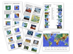
Deserts:
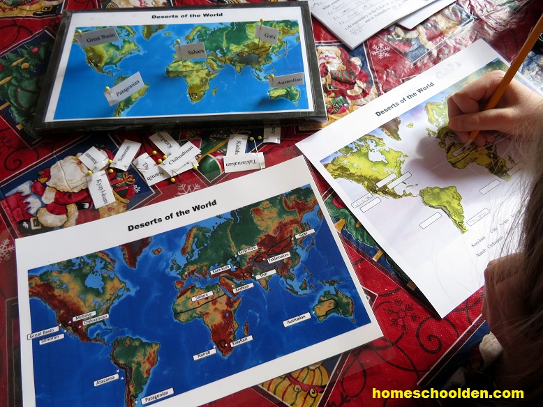
A couple of years ago, when we did our Ocean Unit we spent quite a bit of time learning the location of the world oceans, seas and straits. I wanted to focus on some of the world deserts. We focused on 15: Kara-kum Gobi Sahara Arabian Thar Great Basin Australian Patagonian Namib Chihuahuan and others.
There are several pages in this section. Each day, I had the kids fill in 4 or 5 deserts on their worksheet. In the picture below, we were running out of blue ink for the picture that DD is filling in!) I also made a pin map — and the instructions and printable for that are included in the pin map. The good thing about the pin map is that sometime during the day I would have the kids put in the deserts we had gone over. I could quickly check their work or they could check their answers with the answer page (lower left).
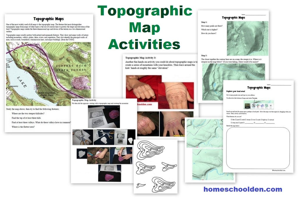
 Topographic Maps
We have several activities planned for this part of the unit. I wanted to share the update with you sooner than later, so I’ll probably come back and add in more details in the next couple of weeks. Here are some of the hands-on activities we plan to do so that the kids really understand how contour maps work.
Our World Facts packet is now 70+ pages (including answer pages). This packet is $6.99. This is a pdf download. You will receive a download link from SendOwl (the automatic delivery service I use) to your PayPal email address.
Feel free to email me if you have any questions!! ~Liesl
Purchase the World Facts Packet – Geographic Features, Landforms, Topographic Maps and more:
$6.99![]() Don’t forget to check your PayPal email address for the download link!
Don’t forget to check your PayPal email address for the download link!
Don’t forget to check your PayPal email address for the download link!
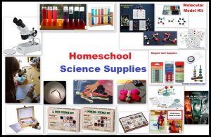
See you again soon here or over at our Homeschool Den Facebook Page! Don’t forget to Subscribe to our Homeschool Den Newsletter. You might also want to check out some of our resources pages above (such as our Science, Language Arts, or History Units Resource Pages) which have links to dozens of posts. You might want to join our free Homeschool Den Chat Facebook group. Don’t forget to check out Our Store as well. ![]() ~Liesl
~Liesl
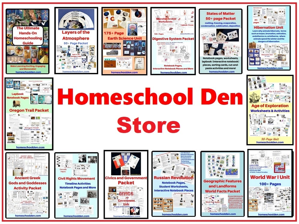
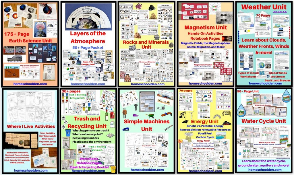
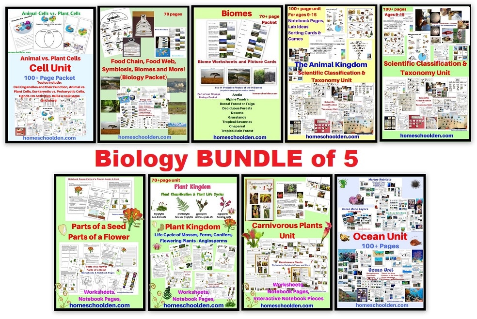
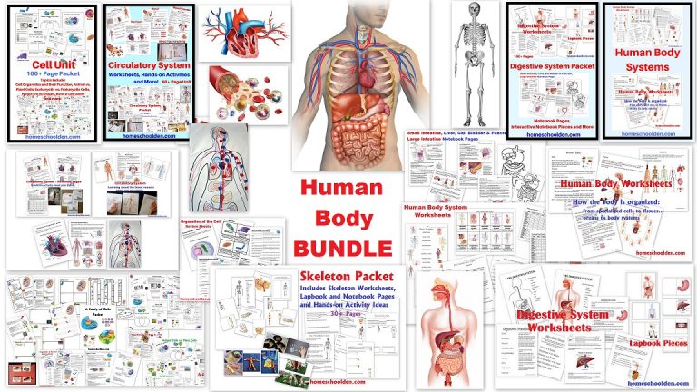
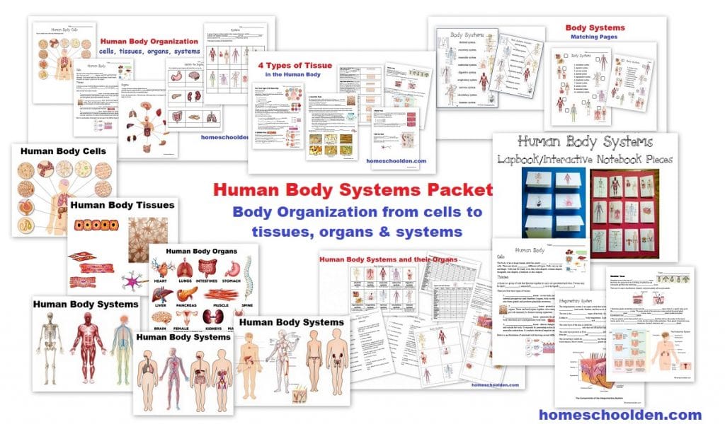
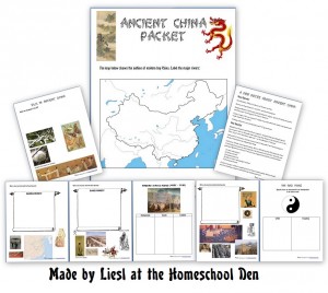
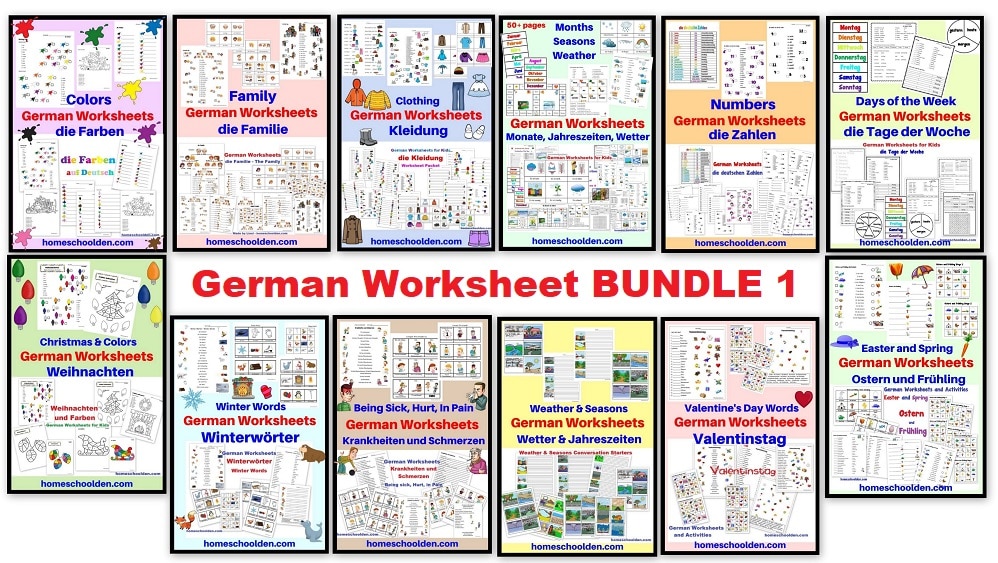
 You can pop over to check out our store here: We have various history and science units, math and spelling packets plus German materials (for beginners) and more! Some of our most popular packets include
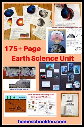
- Earth Science Packet
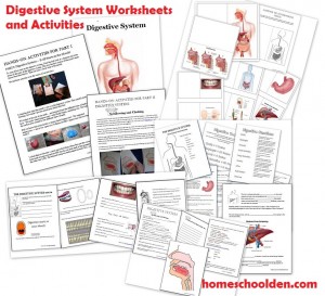
- Digestive System
- Cell Unit
- Ocean Unit
- American Revolution Packet
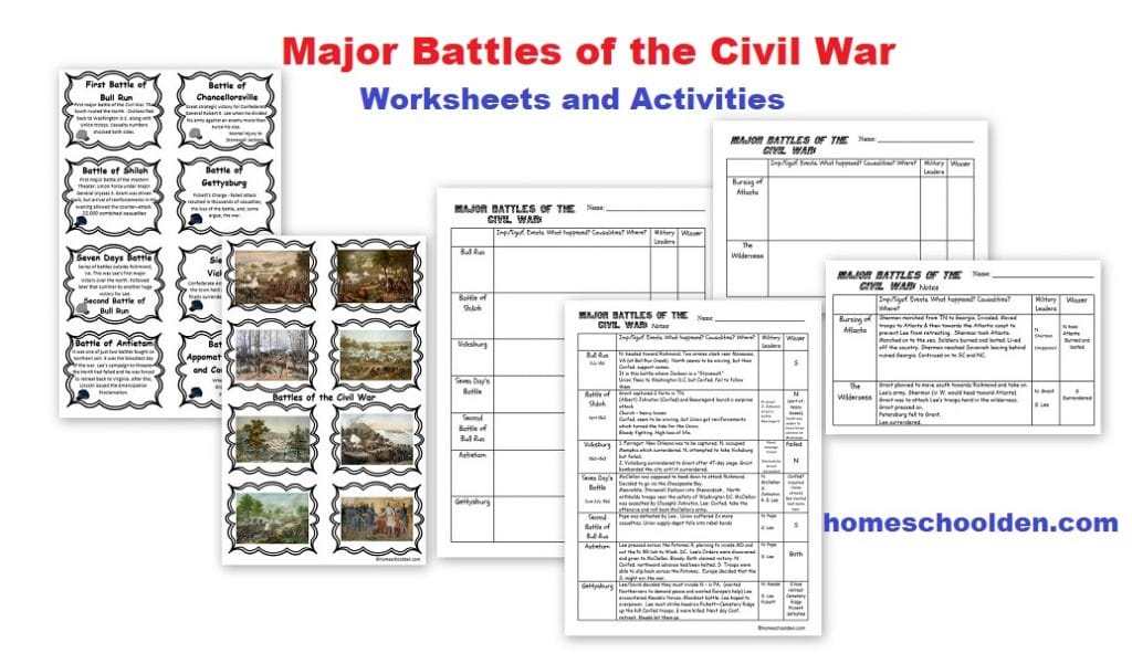
- Slavery and the Civil War Packet (75+ pages)
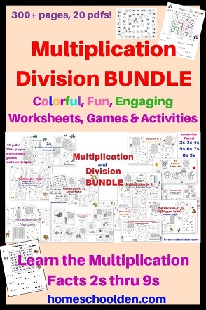
- Multiplication Bundle (175+ pages and 12 pdfs of skip counting activities, games, and colorful, fun math fact worksheets)
Our packets are pdf downloads. ![]()
Disclosure: Please note that some of the links in this post are affiliate links, and at no additional cost to you, I will earn a commission if you decide to make a purchase.
Here are a few of our other packets:
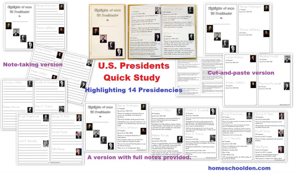
![]() $2.50 U.S. Presidents – Quick Study (A small booklet activity that highlights 14 well-known Presidents) (See more details here)
$2.50 U.S. Presidents – Quick Study (A small booklet activity that highlights 14 well-known Presidents) (See more details here)
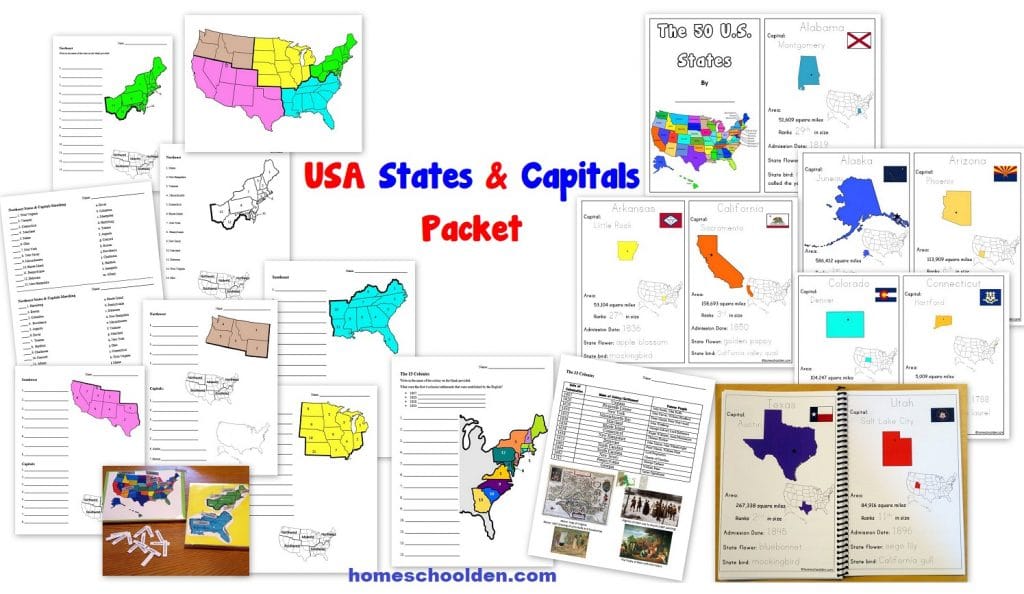
![]() $7.99 U.S. States and Capitals Packet This 100+ page packet helps students learn the U.S. states and capitals. It includes US geography worksheets, a states & capitals booklet, 13 colonies maps and more! Visit Post or View image
$7.99 U.S. States and Capitals Packet This 100+ page packet helps students learn the U.S. states and capitals. It includes US geography worksheets, a states & capitals booklet, 13 colonies maps and more! Visit Post or View image

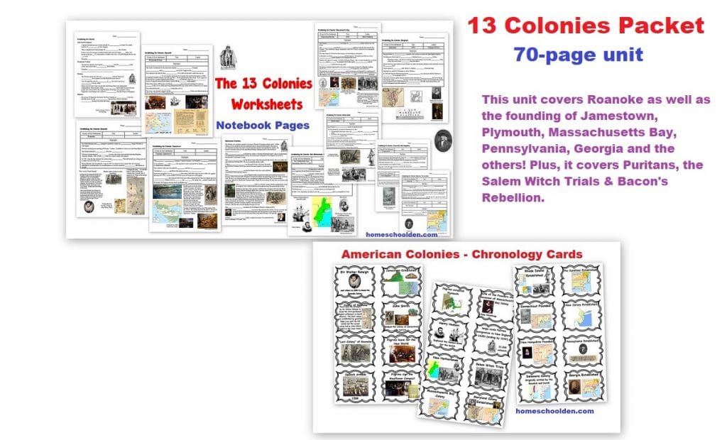
![]() $6.99 13 Colonies Unit – a 70-page unit that covers Roanoke, Jamestown, Plymouth, Massachusetts Bay, Pennsylvania, Georgia and the others. Plus, it explores the Puritans, Salem Witch Trials & Bacon’s Rebellion. Visit Post
$6.99 13 Colonies Unit – a 70-page unit that covers Roanoke, Jamestown, Plymouth, Massachusetts Bay, Pennsylvania, Georgia and the others. Plus, it explores the Puritans, Salem Witch Trials & Bacon’s Rebellion. Visit Post
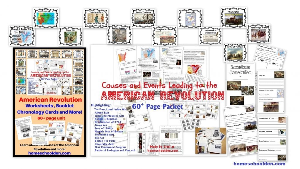
![]() $7.99 Causes of the American Revolution Packet (and American Revolution play) (See more details here)
$7.99 Causes of the American Revolution Packet (and American Revolution play) (See more details here)
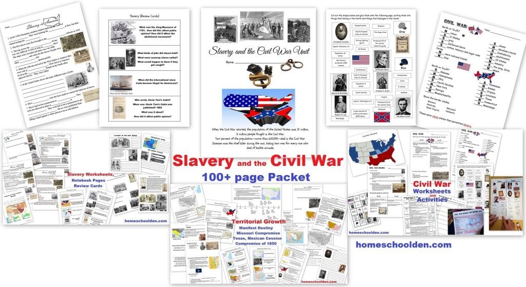
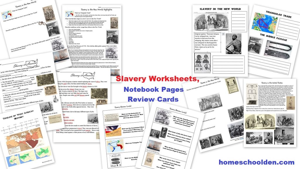
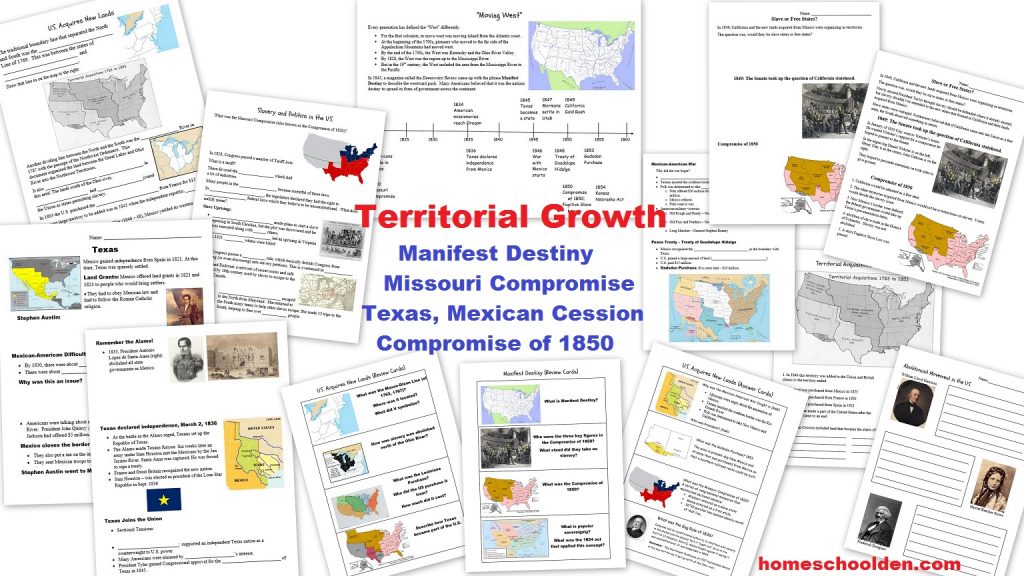
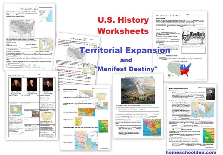
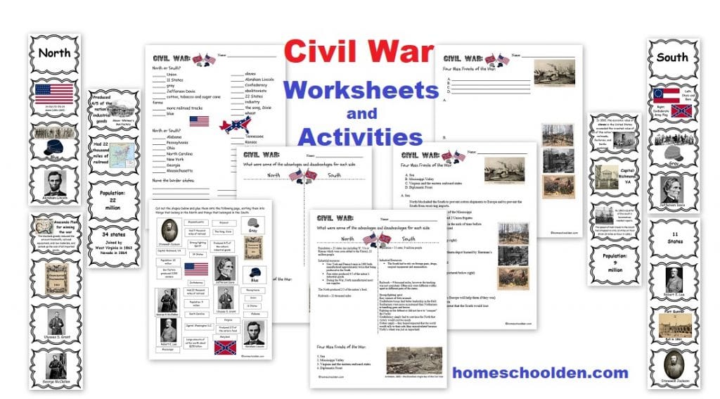
![]() $7.99 Slavery and the Civil War (100 pages – slavery, U.S. territorial expansion, the Civil War) (See more details here) or view image 1, image 2, image 3, image 4, image 5, image 6, image 7, image 8
$7.99 Slavery and the Civil War (100 pages – slavery, U.S. territorial expansion, the Civil War) (See more details here) or view image 1, image 2, image 3, image 4, image 5, image 6, image 7, image 8

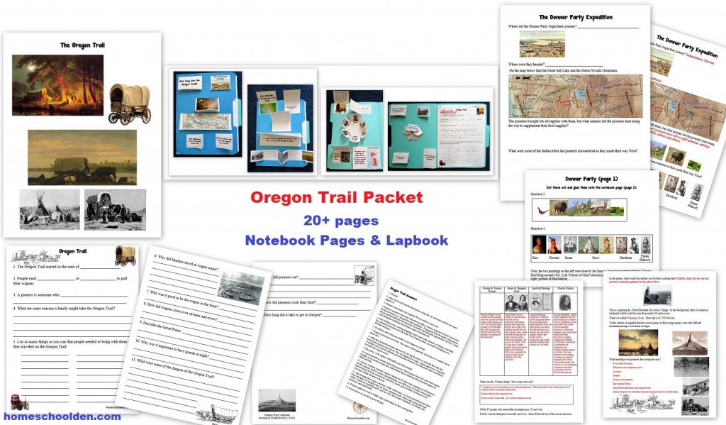
![]() $4.99 Oregon Trail Packet Quick Preview
$4.99 Oregon Trail Packet Quick Preview
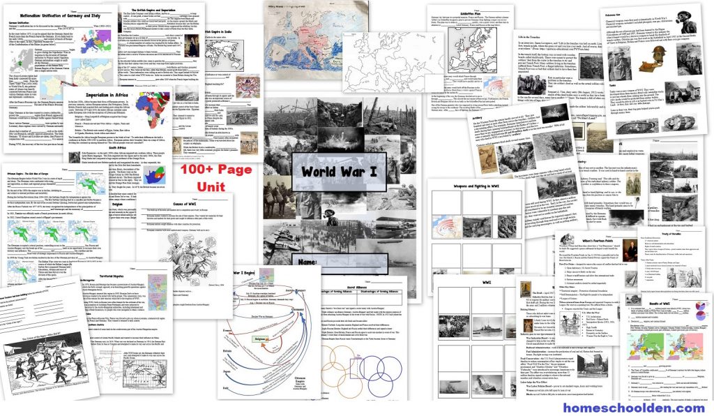
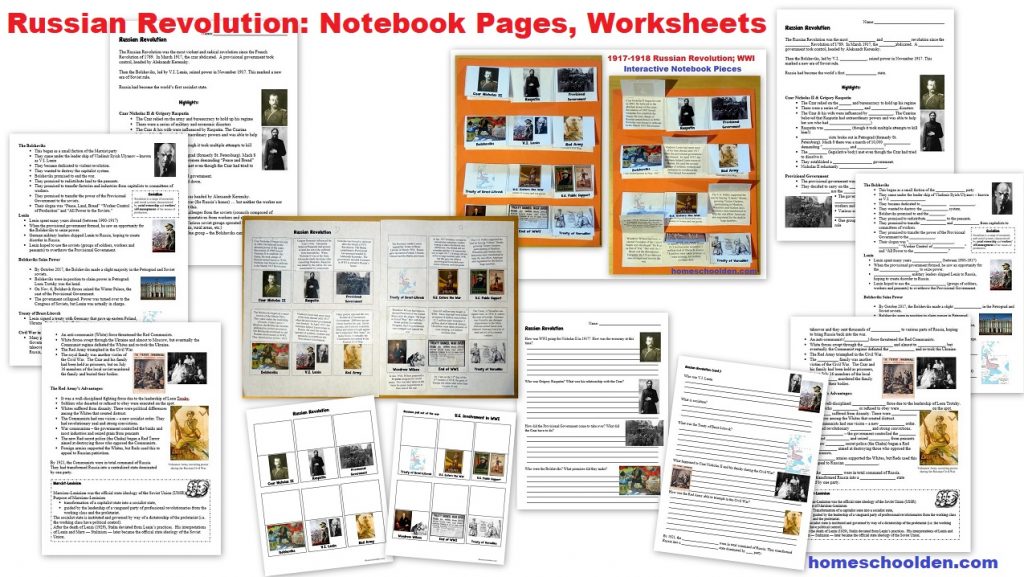
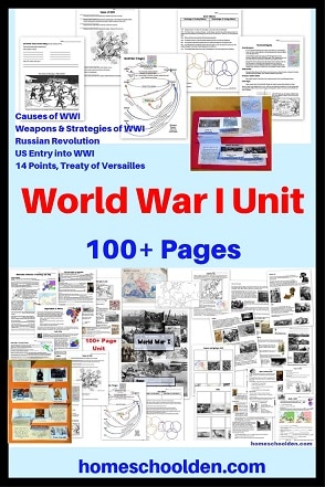
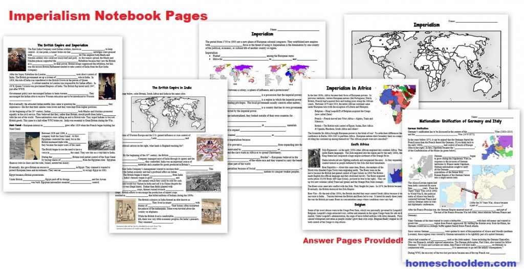
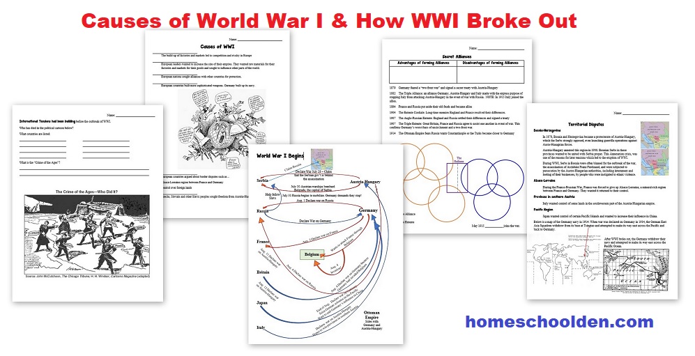
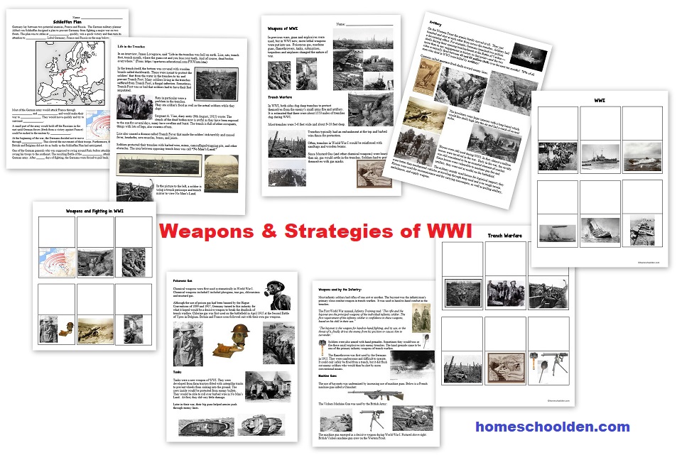
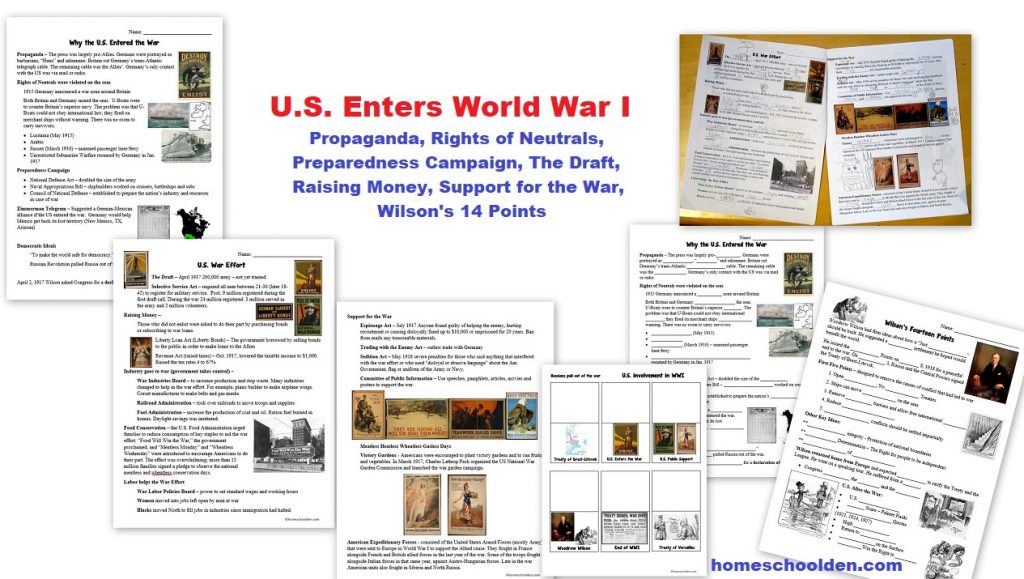
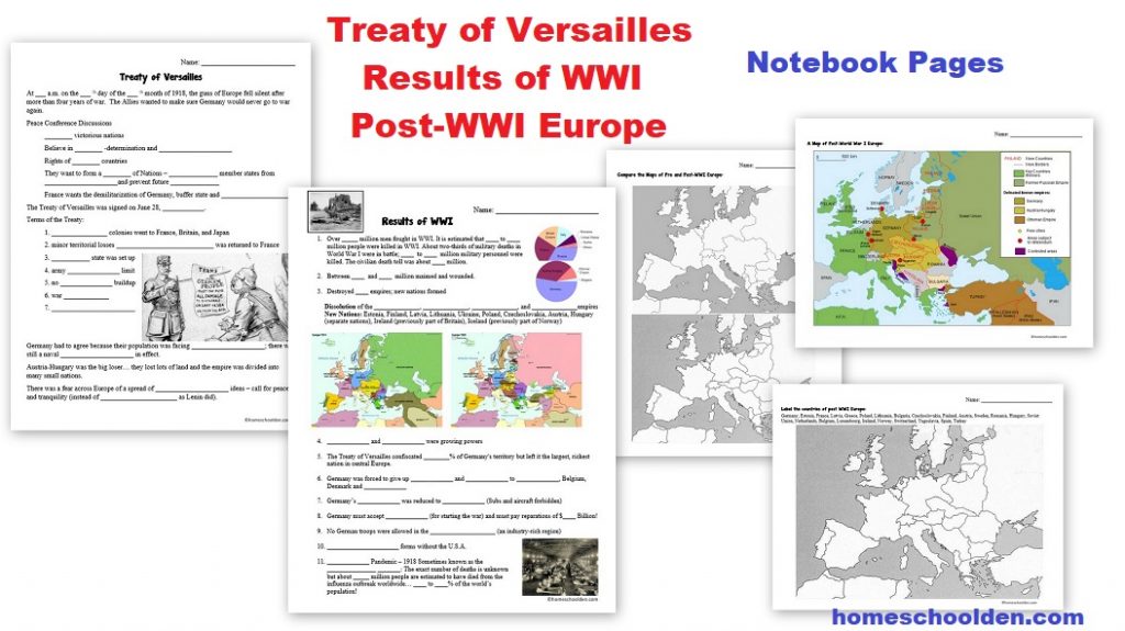
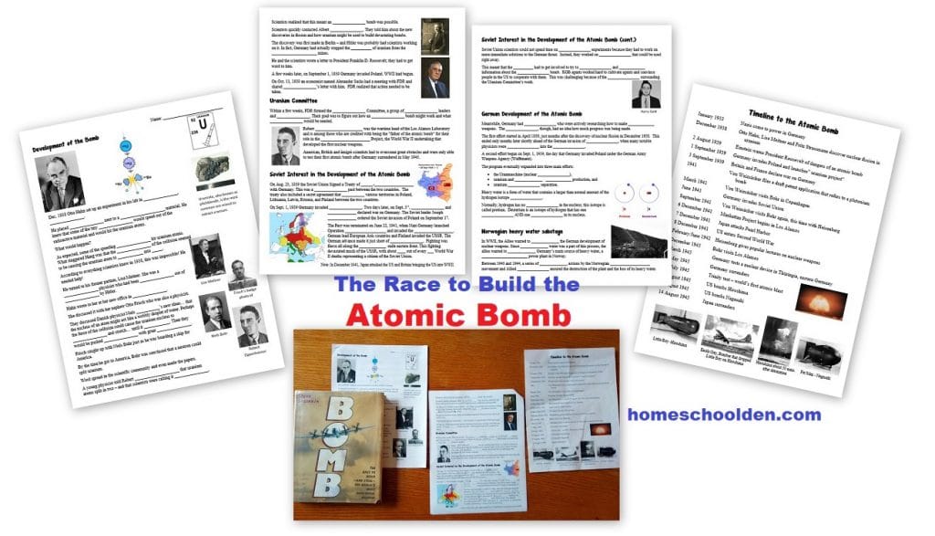
![]() $9.99 World War I Packet 100+ pages (includes material on the Russian Revolution) World War I – Quick Preview or visit the post or view image 1, image 2, image 3, image 4, image 5, image 6, image 7
$9.99 World War I Packet 100+ pages (includes material on the Russian Revolution) World War I – Quick Preview or visit the post or view image 1, image 2, image 3, image 4, image 5, image 6, image 7
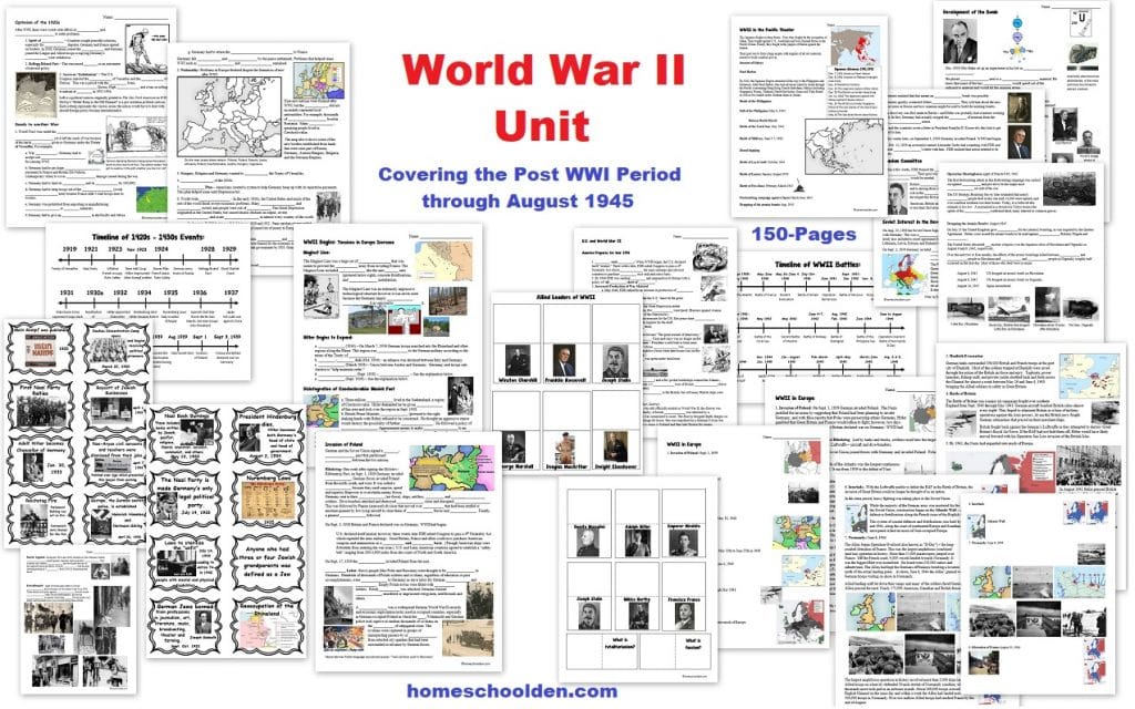
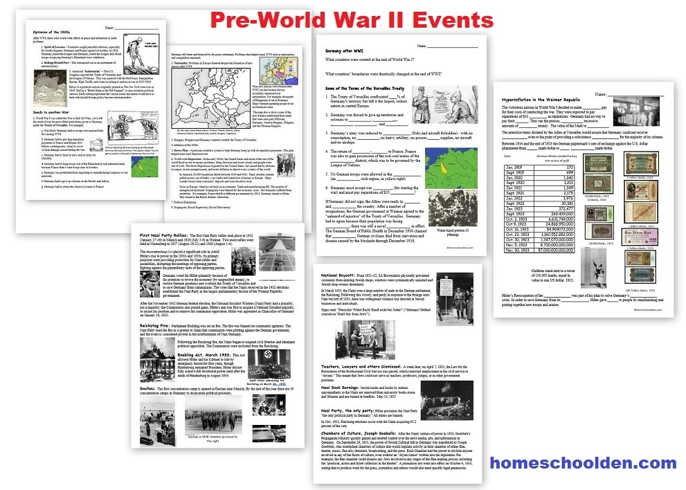
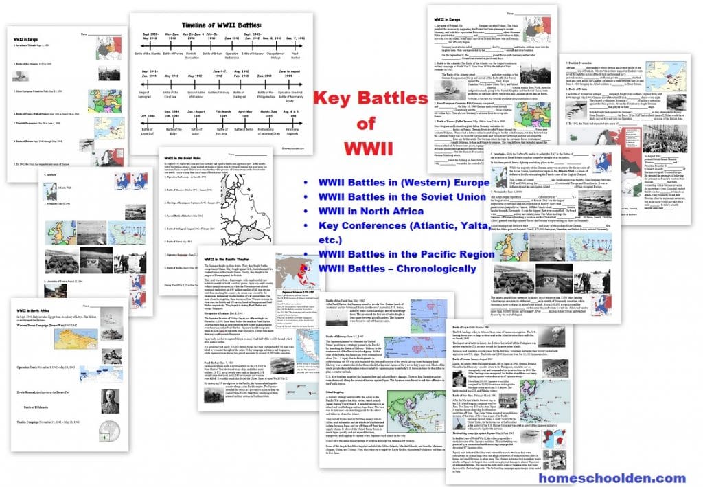
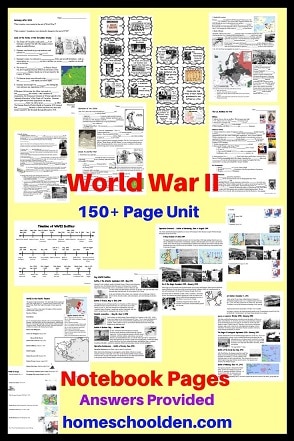
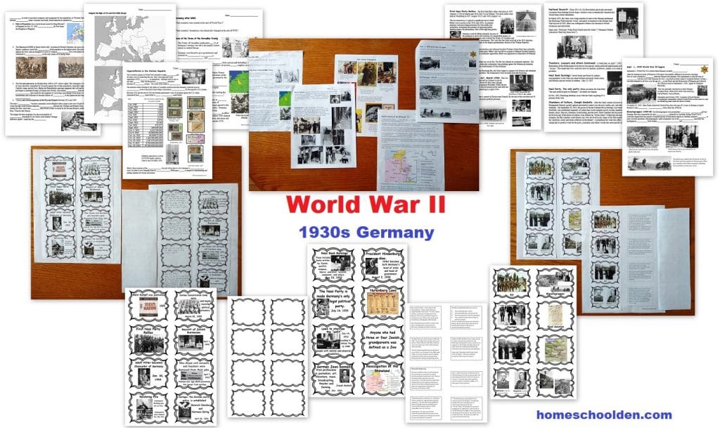
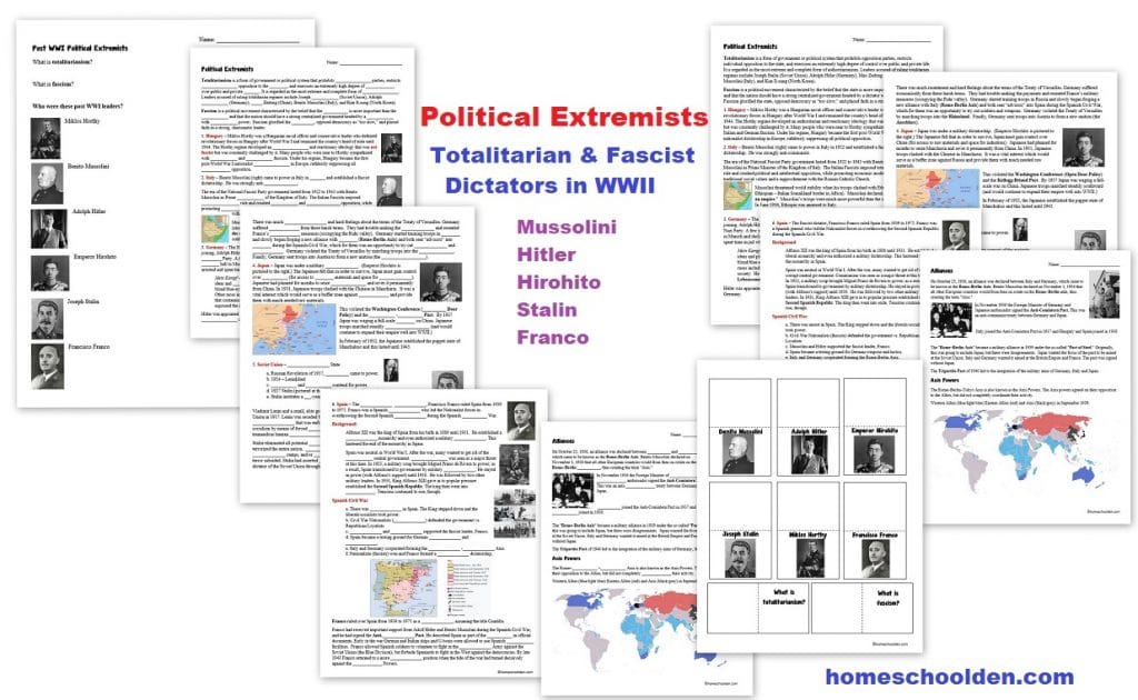
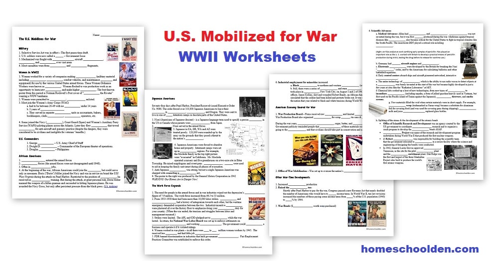
![]() $9.99 World War II Unit (150 pages) from the post WWI period through Aug. 1945. Visit the post for more details. View image 1, image 2, image 3, image 4, image 5, image 6, image 7
$9.99 World War II Unit (150 pages) from the post WWI period through Aug. 1945. Visit the post for more details. View image 1, image 2, image 3, image 4, image 5, image 6, image 7
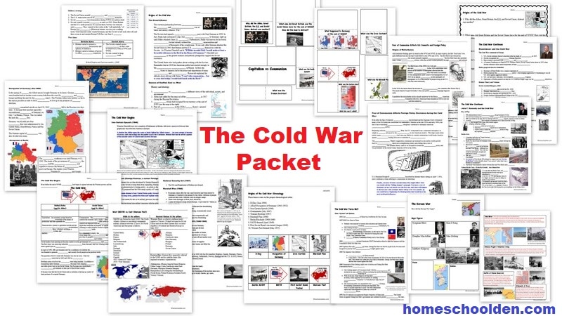
 Cold War Packet – See the History Page for more details.
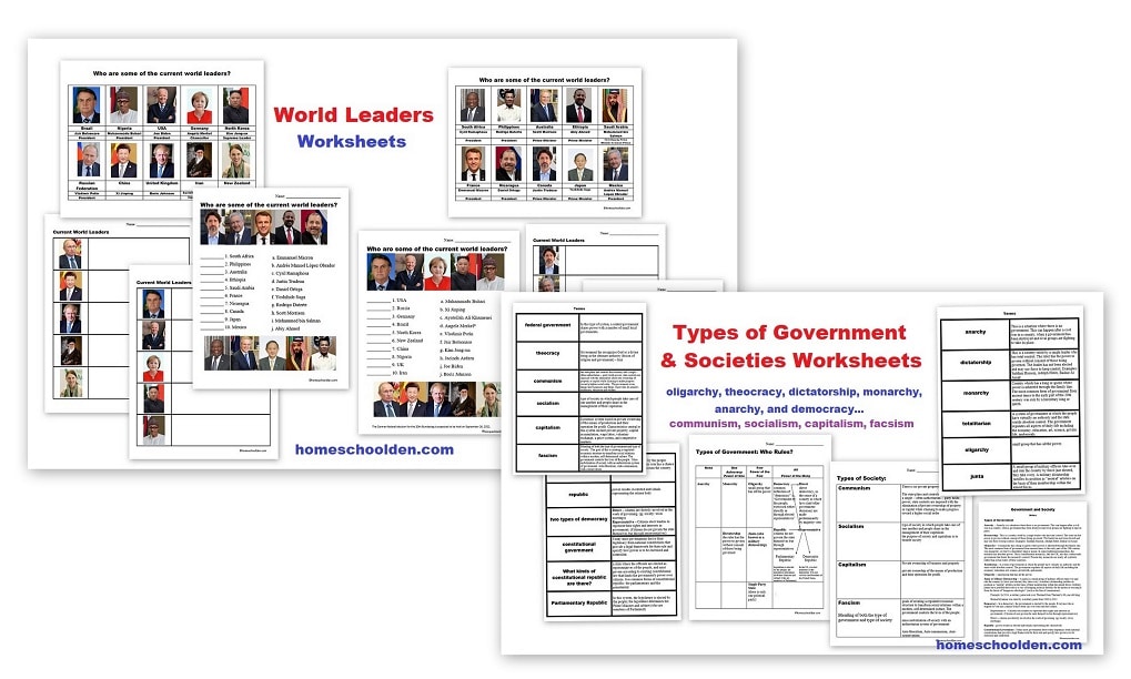
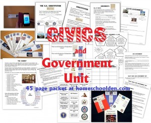
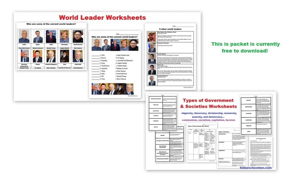
![]() $0.00 Types of Governments & Societies; Current World Leaders Packet (Worksheets on current world leaders, Types of Governments… ie oligarchy, theocracy, dictatorship, monarchy, and democracy plus Types of Societies… ie. communism, socialism, capitalism, fascism.) Visit Post or View Image
$0.00 Types of Governments & Societies; Current World Leaders Packet (Worksheets on current world leaders, Types of Governments… ie oligarchy, theocracy, dictatorship, monarchy, and democracy plus Types of Societies… ie. communism, socialism, capitalism, fascism.) Visit Post or View Image
Don’t forget to check your PayPal email address for the download link.

See you again soon here or over at our Homeschool Den Facebook Page! Don’t forget to Subscribe to our Homeschool Den Newsletter. You might also want to check out some of our resources pages above (such as our Science, Language Arts, or History Units Resource Pages) which have links to dozens of posts. You might want to join our free Homeschool Den Chat Facebook group. Don’t forget to check out Our Store as well. ![]() ~Liesl
~Liesl
Again, if you are interested in joining our Homeschool Den Newsletter, feel free to subscribe here. It’s a great way to hear about our latest packets and to learn about many of the hundreds of printables & other materials we have tucked away on the blog!
 Happy Homeschooling! ~Liesl


you’re a sanity saver
I’m so glad you liked the unit! Happy Homeschooling! ~Liesl