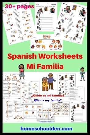
Earth Space Science: Topographic Maps
We read the second chapter in the geology book we have from Real Science 4 Kids. It talked about the different tools that geologists use — including topographic maps. I wasn’t sure the kids thoroughly understood how the maps worked and looked around for some resources to help them understand. I found a couple of wonderful activities!
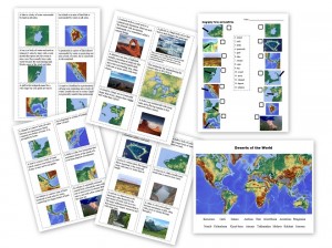
We actually started with this topographic map page from the USGS:
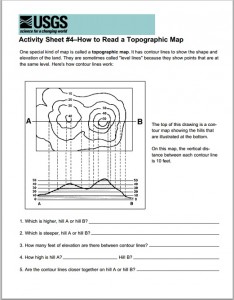
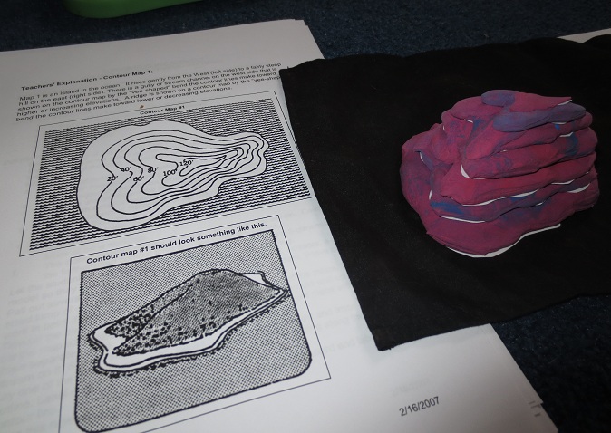
I thought that page explained the elevations really well. Then we went on to build the 3-d version of a topographic map. This packet of topographic map activities had a topographic map you could cut out. I cut out the diagram and then cut piece by piece out of card stock. I kept the diagram (lower right photo) that shows what the island looks like hidden from the kids until we completed the activity.
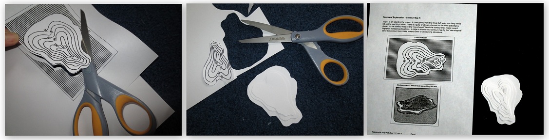 After cutting out the pieces, I realized we needed to make it clear which side was up. I put a dot on each piece. Then we used modeling magic clay, which we realized we could cut with scissors. After they were the right shape, we stacked them on top of one another and compared it to the diagram.
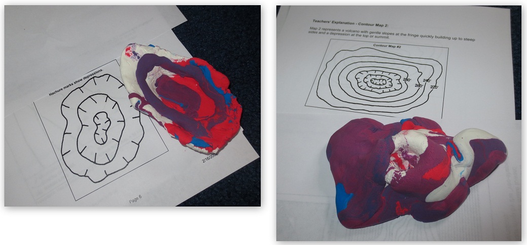
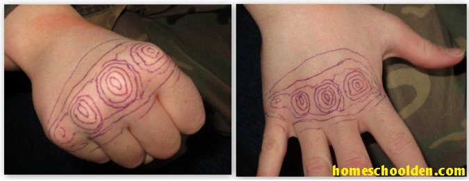
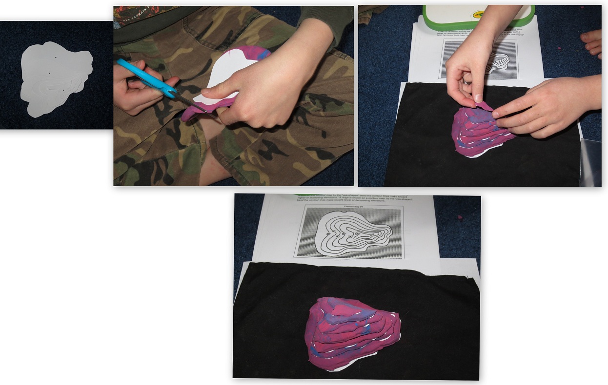 We then learned about how depressions are marked on the map. It’s really hard to tell from the pictures below because our model magic was a combination of colors, but our creations were like a crater and a volcano. Again, we got those sheets from here: topographic map activities.
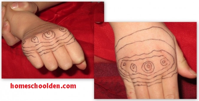
 The last activity we did was a Boy Scout activity I came across. All three kids LOVED this!! We drew elevation marks around their knuckles, then they flattened out their hands. That sure pulled all this together for us!
 and here’s DD’s topographic hand!
We’ve sure had fun with this unit!
This is an activity we did when we did our World Facts Packet. Be sure to check that post out for more details!
Part I: World Facts — Do your kids know the largest countries? the countries with the largest populations? the longest river? tallest mountain? the major world landmarks? This first part of the packet goes over basic facts about the world and about the U.S.A.
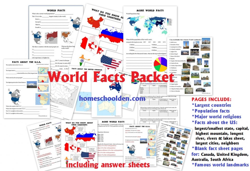
Part II: Geography Landforms – This second half goes over landform words from simple terms (like islands, lakes to the difference between bays, gulfs and sounds or between a delta and an estuary.)

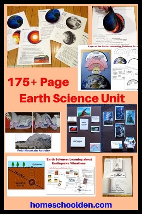
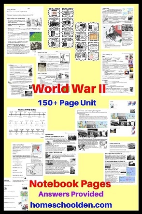
You might be interested in our 150+ pageEarth Scienc packet. See more details here:

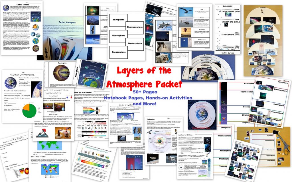
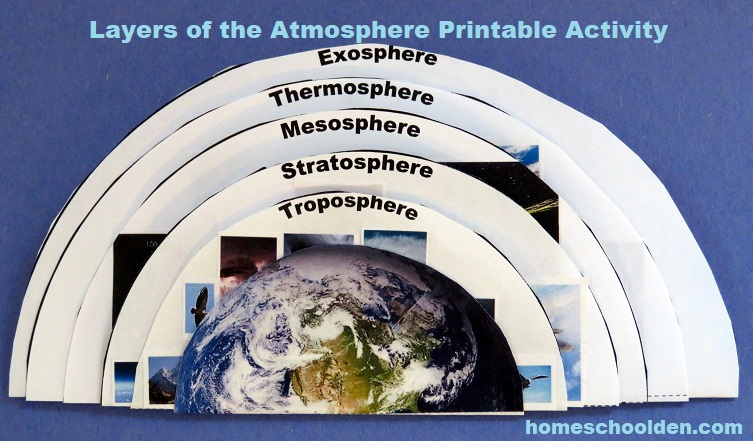
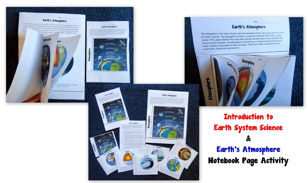
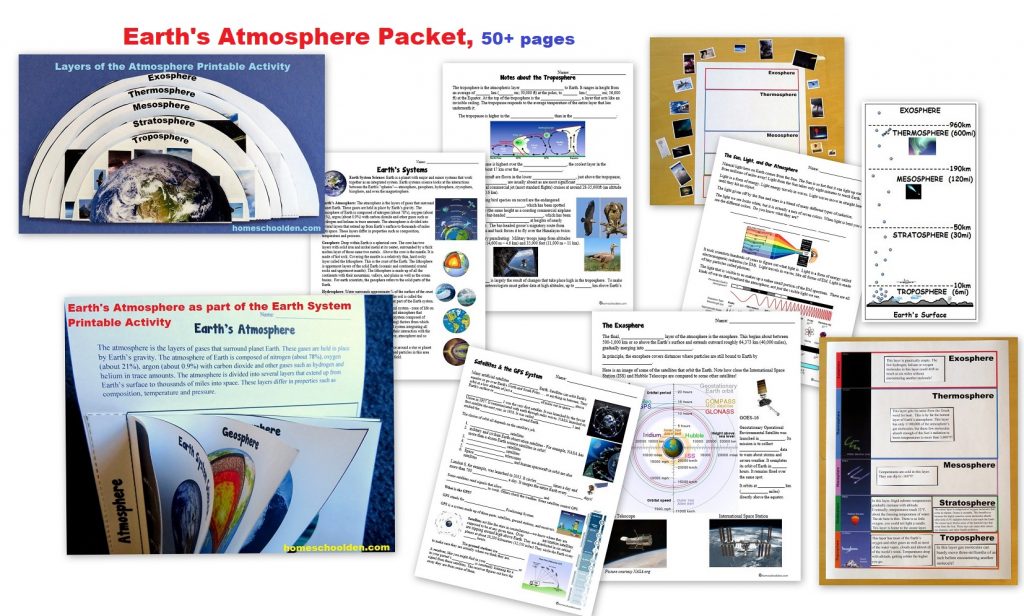
You might also want to check out our Layers of the Atmosphere Packet
 You will find this packet and more in our Store!
You might also be interested in these related posts:
- Learning about the Solar System – Including the hands-on kit the kids loved assembling and painting.
- Earth Science: Timeline of Earth Activity – A Montessori activity that is meant to impress kids with the enormity of time on Earth.
- Earth Science: Layers of the Earth hands-on Activity
- Earth’s Geologic Timeline – How scientists divide Earth’s history into eons and eras
- Learning about Latitude and Longitude, Using a Compass
- Earth Science: Plate Movement Hands-On Activities
- Earth Science: Layers of the Atmosphere
- Earth Science Packet: Layers of the Atmosphere
- Earth Science: Layers of the Earth Hands-On Activity
- Earth Science: Plate Movements, Pangea
- Plate Movement and Earthquakes
- Earth Science: Plate Movements and Earthquakes, Volcanoes and Mountain Making
- Earth Science: How Fold Mountains are Formed
- Topographic Maps
- World Biomes Pin Map
- Preschool Geography and More Preschool Geography Activities
See you again soon here or over at our Homeschool Den Facebook Page! Don’t forget to Subscribe to our Homeschool Den Newsletter. You might also want to check out some of our resources pages above (such as our Science, Language Arts, or History Units Resource Pages) which have links to dozens of posts. You might want to join our free Homeschool Den Chat Facebook group. Don’t forget to check out Our Store as well. ![]()
 Again, if you are interested in joining our Homeschool Den Newsletter, feel free to subscribe here:
 Happy Homeschooling!
~Liesl


3 Responses
[…] Earth-Space Science: Topographic Maps […]
[…] Earth-Space Science: Topographic Maps […]
[…] Earth-Space Science: Topographic Maps […]