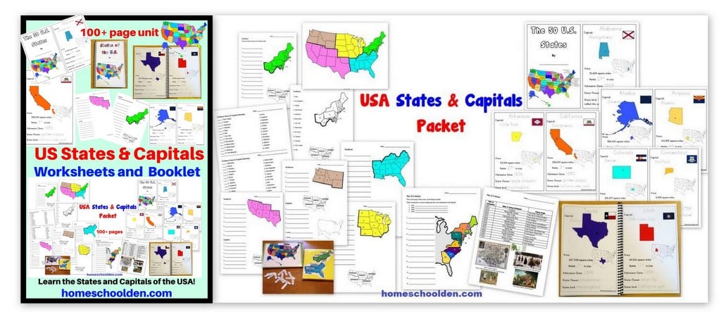
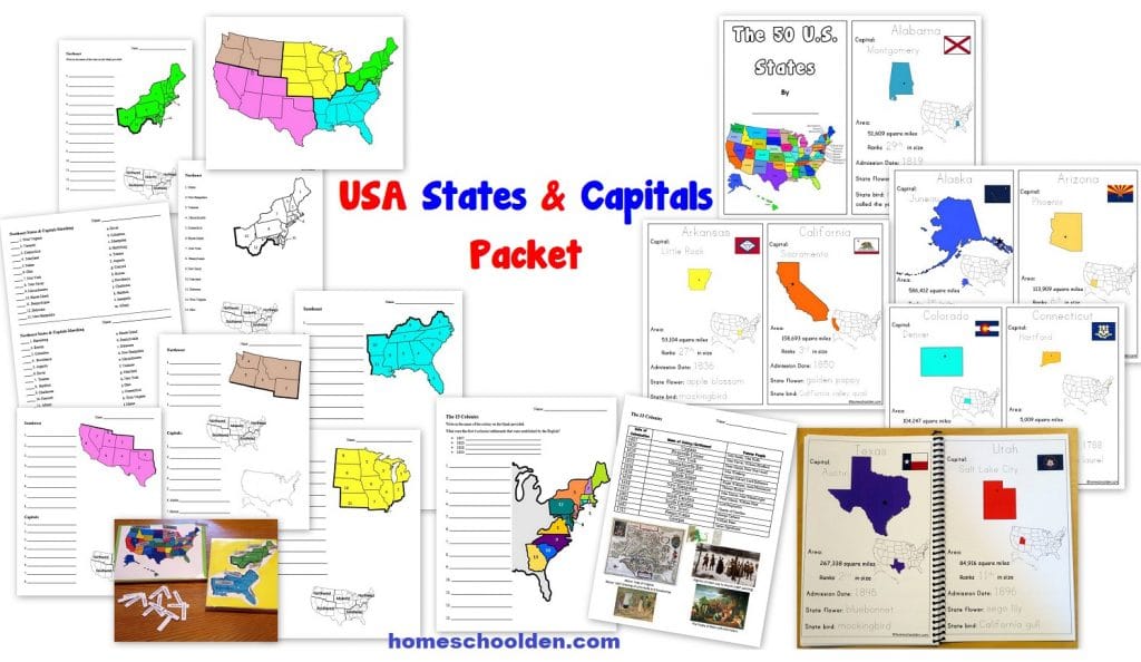
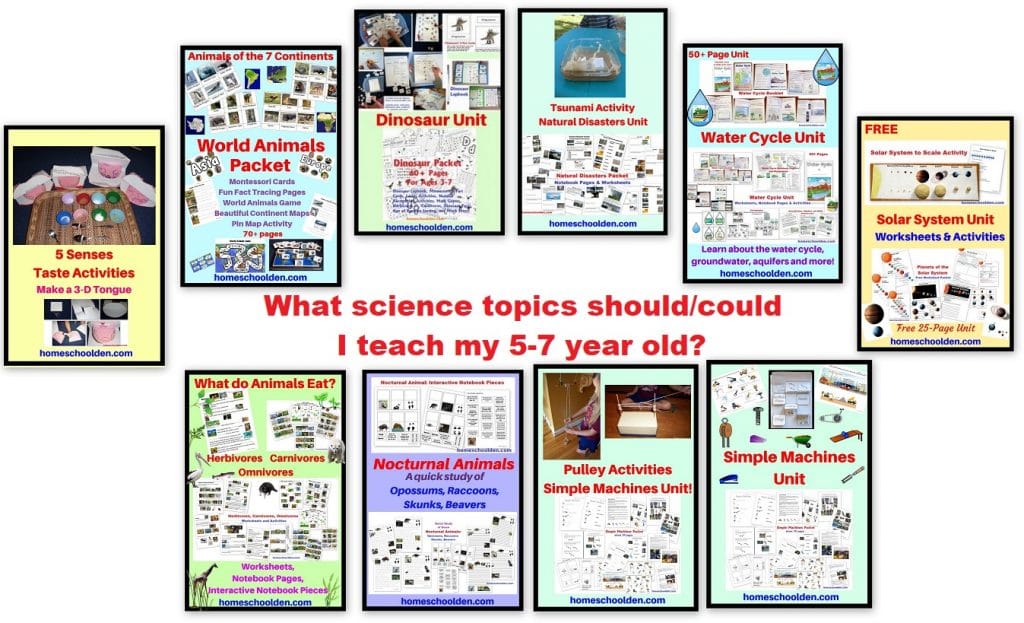
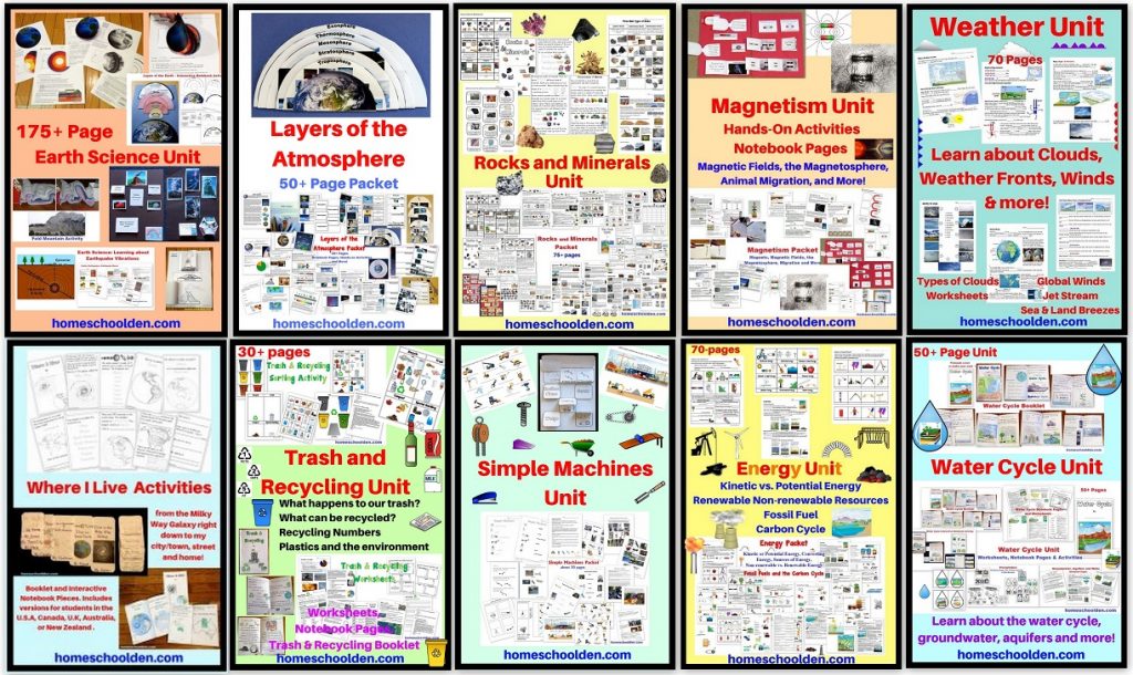
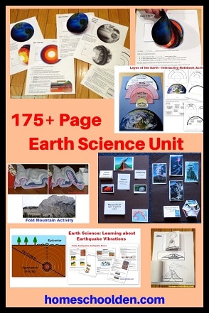
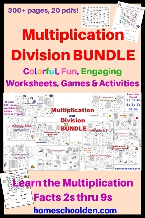
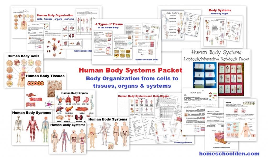
USA States and Capitals Packet
This new 100+ page packet will help your student/s learn the U.S. states and capitals. We are doing American History this year and I wanted to be sure the kids had a good foundation in U.S. geography.
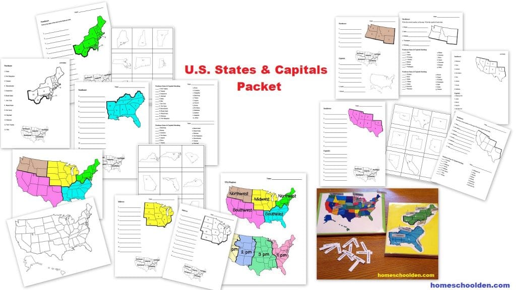
U.S. regions worksheets:
The 50+ pages of geography worksheets are organized by regions:
- Northeast
- Southeast
- Midwest
- Northwest (plus Alaska and Hawaii)
- Southwest
We’ll go over the state’s location and the capitals of the states in those regions just to put things into manageable chunks!
These US geography worksheets include regional maps (in color or black & white), state shapes worksheets, as well as states-capitals matching pages.
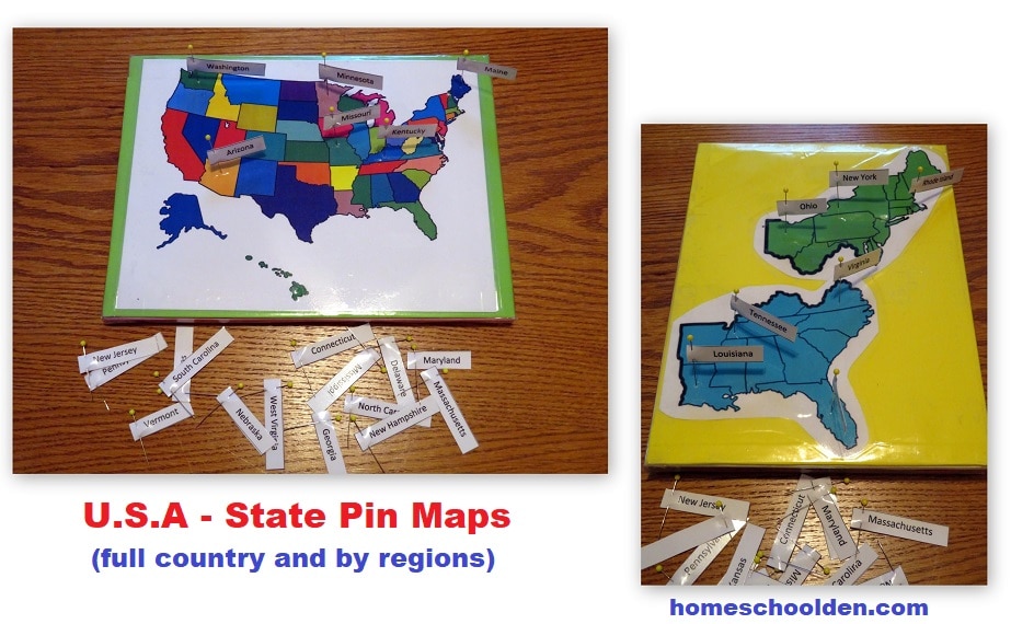
USA Pin Map:
As you can see in the picture above, we also made a USA pin map that we’ll use as they learn/review the location of all the U.S. states. Pin maps are really easy to make and I have printable maps and full instructions on how to make your own in the packet. 🙂
My kids love reviewing with pin maps!
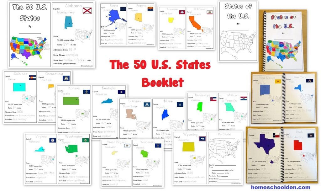
USA States & Capitals Booklet:
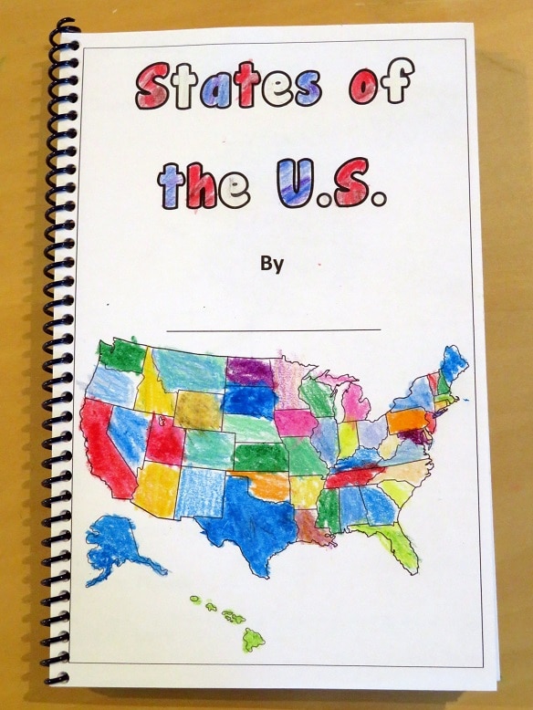
There is also a USA States and Capitals booklet. This booklet covers the 50 U.S. states, their capitals, and basic information.
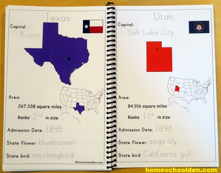
Students can trace some of the basic information about each state including the state’s capital, area (in square miles) & relative size (biggest, 3rd biggest, 44th in size and so forth!), the admission date, state flower and state bird.
 We are not spending a lot of time on the geography, but with this activity my youngest can work on her own while I work with my older two on other things. (You know how that goes, right?!!)
Students can color in the front page (as ED did in the example above) or there is a colored version you can print out (that matches the colors within the booklet).
I printed the pages out one-sided, then folded the pages in half. As you can see, I decided to bind ED’s booklet together.
Here is a close up of the states, Texas and Utah:
The booklet places the states in alphabetical order, so if your kids are learning the USA song this booklet is perfect!
Here is the fun video of 50 States That Rhyme. I included the song lyrics at the end of the packet or you can find it here: The Fifty States that Rhyme Song Lyrics (free printable). My kids really loved learning the 50 States song!
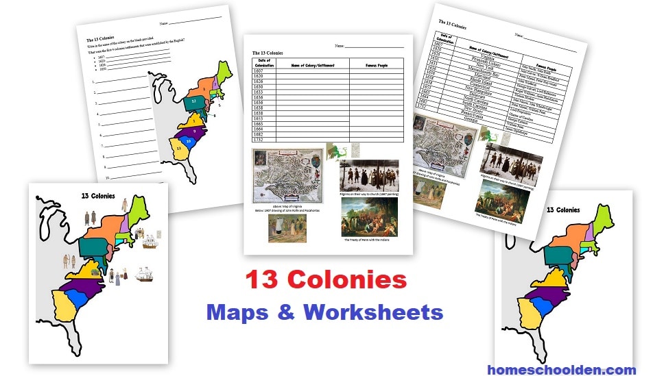
As I mentioned above, we are covering American History this year. I also made a few new worksheets about the 13 colonies that are included in this packet. I made the larger map into a pin map.
The USA States and Capitals Packet is $7.99. I hope it is helpful!
This packet is just over 100 pages. This is a PDF download. You will receive a download link from SendOwl (the automatic delivery service I use) to your PayPal email address. If you have any questions or need help, free feel to email me! ~Liesl
U.S.A. States and Capitals Packet
$7.99

Don’t forget to check your PayPal email address for the download link.
Some other our materials that may be of interest:
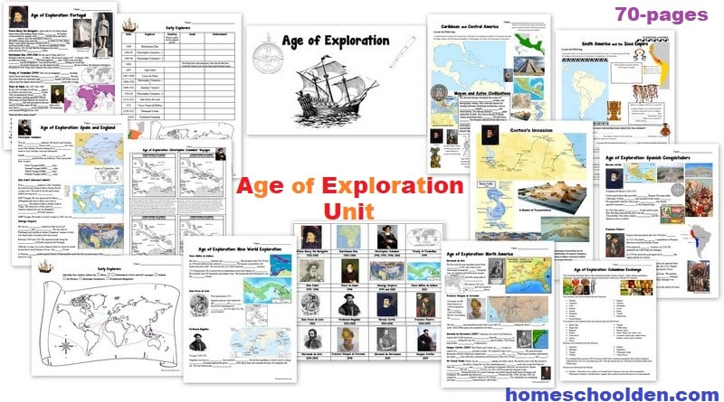
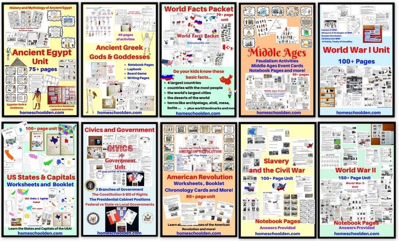
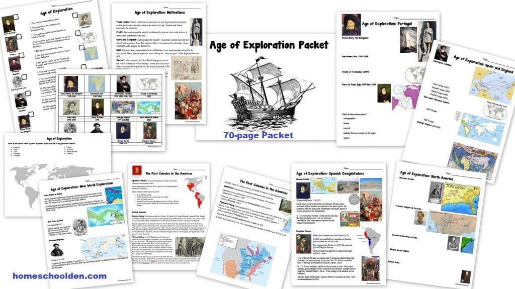
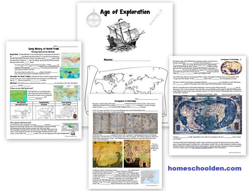
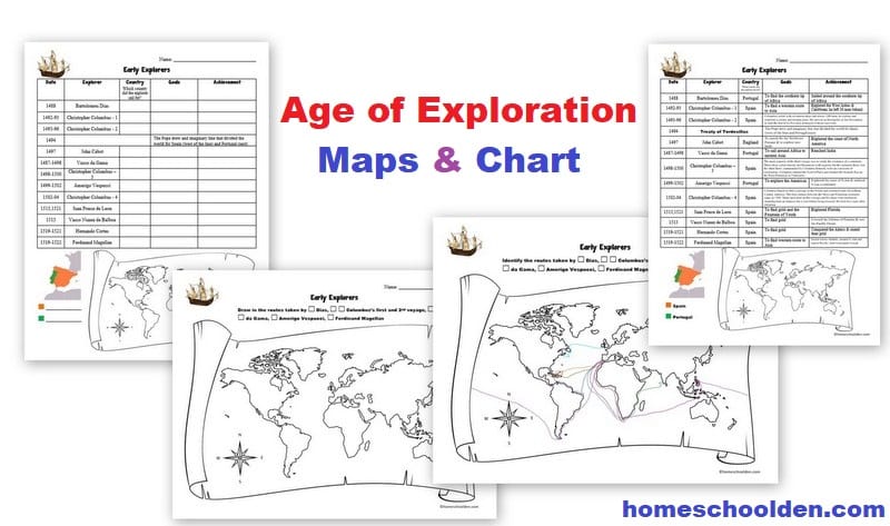
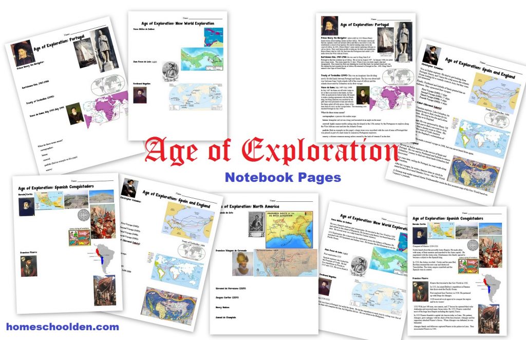
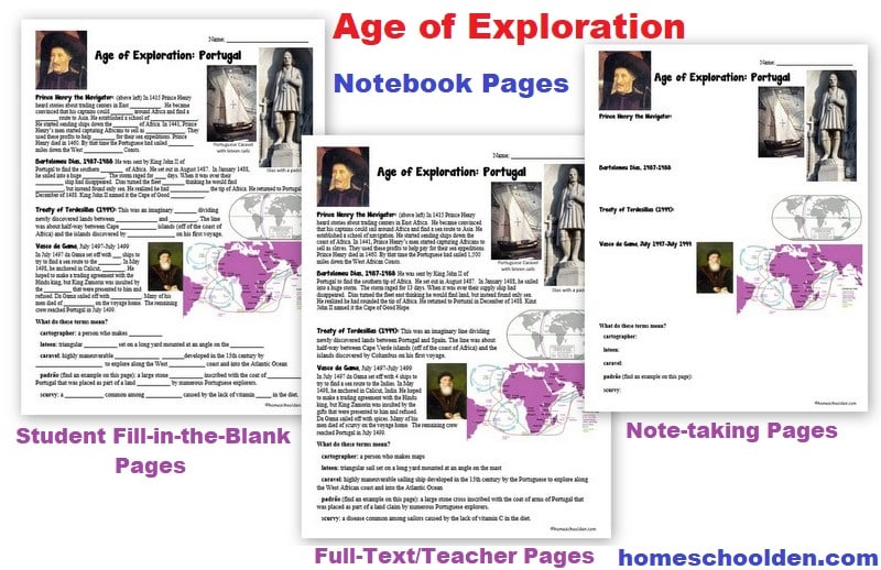
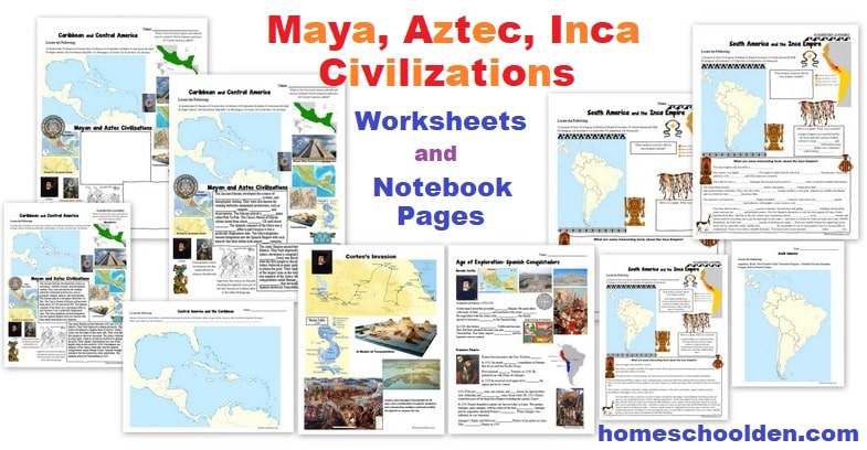
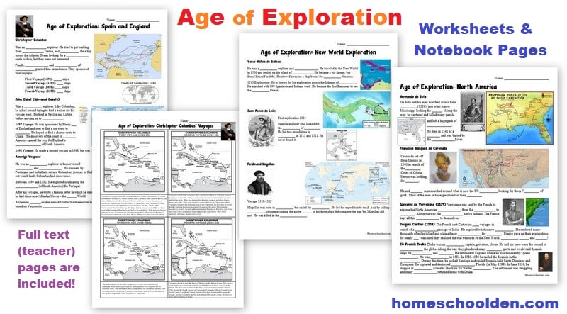
![]() $6.99 Age of Exploration Packet – (70-pages) This packet covers the voyages of the early explorers (1400-1550) including Dias, da Gama, Columbus, Cabot, Vespucci, Ponce de Leon, Balboa, Cortes, Magellan, Pizarro, de Soto, Coronado, Verrazono, Cartier, Drake and others. It also includes a few notebook pages about the Maya, Aztec and Inca civilizations. This packet includes notebook pages (both student and teacher/full-text pages) as well as worksheets, timeline cards and maps. Visit the Post. View image 1, image 2, image 3, image 4, image 5, image 6, image 7, image 8
$6.99 Age of Exploration Packet – (70-pages) This packet covers the voyages of the early explorers (1400-1550) including Dias, da Gama, Columbus, Cabot, Vespucci, Ponce de Leon, Balboa, Cortes, Magellan, Pizarro, de Soto, Coronado, Verrazono, Cartier, Drake and others. It also includes a few notebook pages about the Maya, Aztec and Inca civilizations. This packet includes notebook pages (both student and teacher/full-text pages) as well as worksheets, timeline cards and maps. Visit the Post. View image 1, image 2, image 3, image 4, image 5, image 6, image 7, image 8
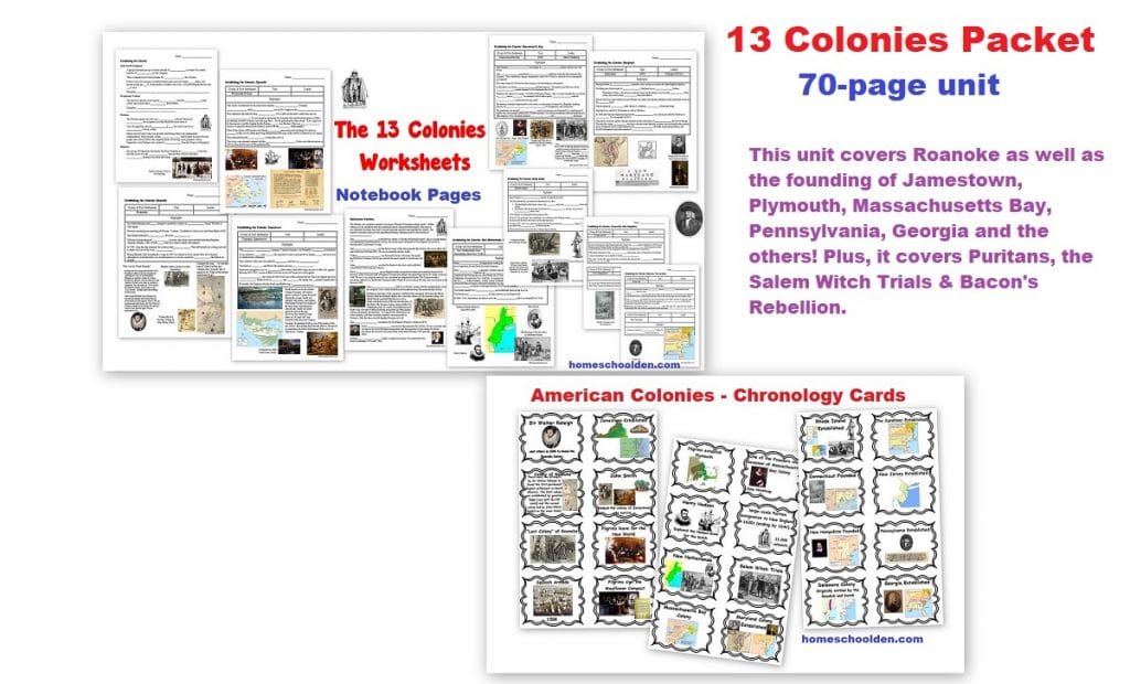
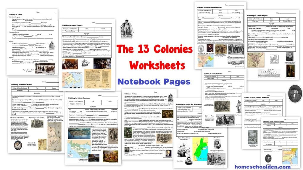
![]() $6.99 13 Colonies Unit – a 70-page unit that covers Roanoke, Jamestown, Plymouth, Massachusetts Bay, Pennsylvania, Georgia and the others. Plus, it explores the Puritans, Salem Witch Trials & Bacon’s Rebellion. More details at this post.
$6.99 13 Colonies Unit – a 70-page unit that covers Roanoke, Jamestown, Plymouth, Massachusetts Bay, Pennsylvania, Georgia and the others. Plus, it explores the Puritans, Salem Witch Trials & Bacon’s Rebellion. More details at this post.
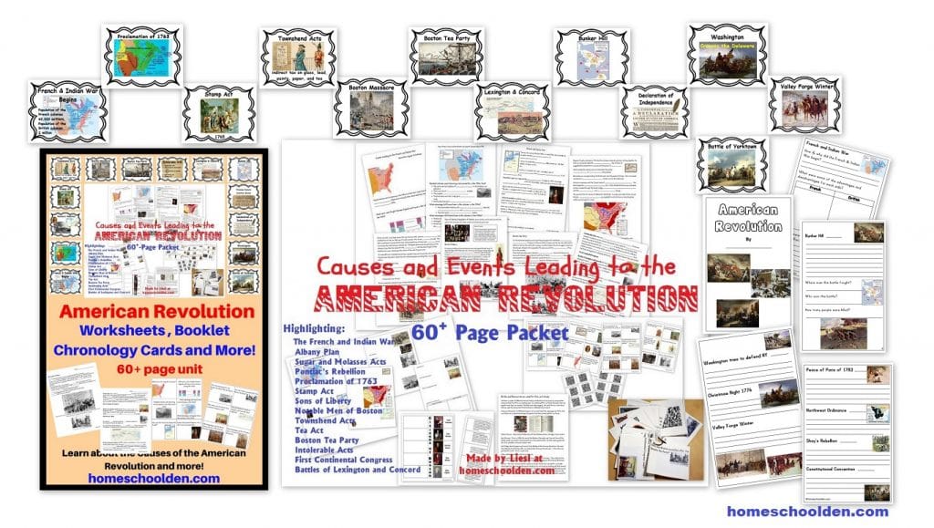
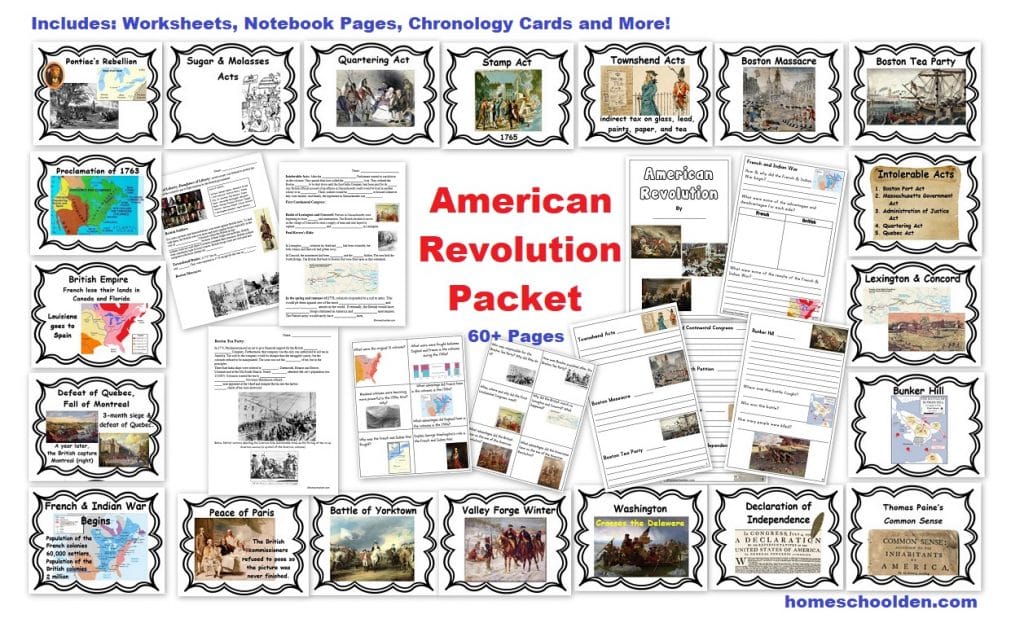
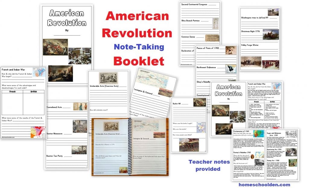
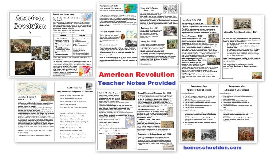
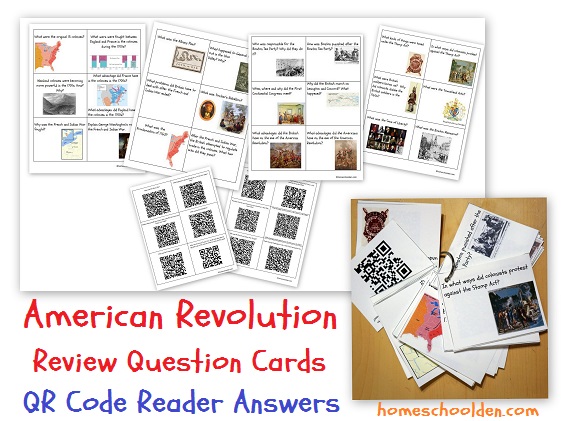
![]() $7.99 American Revolution Packet More details at this post.
$7.99 American Revolution Packet More details at this post.
Don’t forget to check your PayPal email address for the download link.
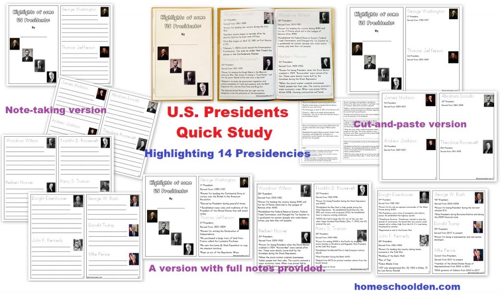
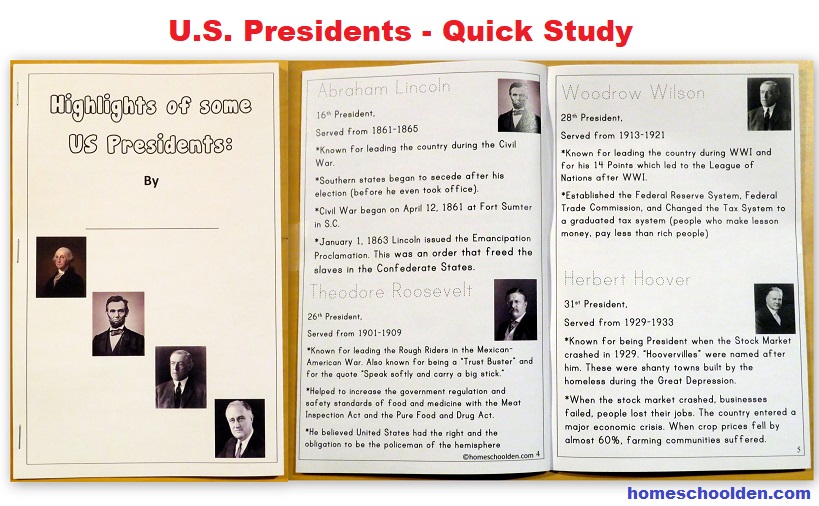
![]() $2.50 U.S. Presidents – Quick Study (A small booklet activity that highlights 14 well-known Presidents)
$2.50 U.S. Presidents – Quick Study (A small booklet activity that highlights 14 well-known Presidents)
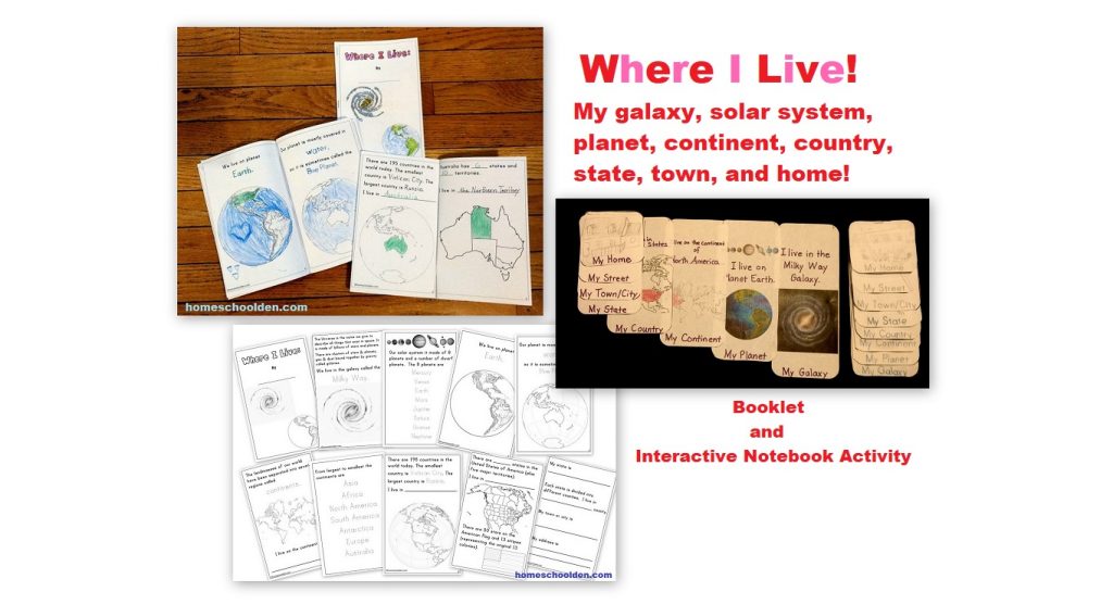
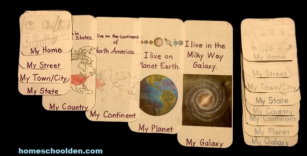
![]() $4.99 Where I Live Activity Packet (Find out more here at this post)
$4.99 Where I Live Activity Packet (Find out more here at this post)
This was how we started the year last year. 🙂
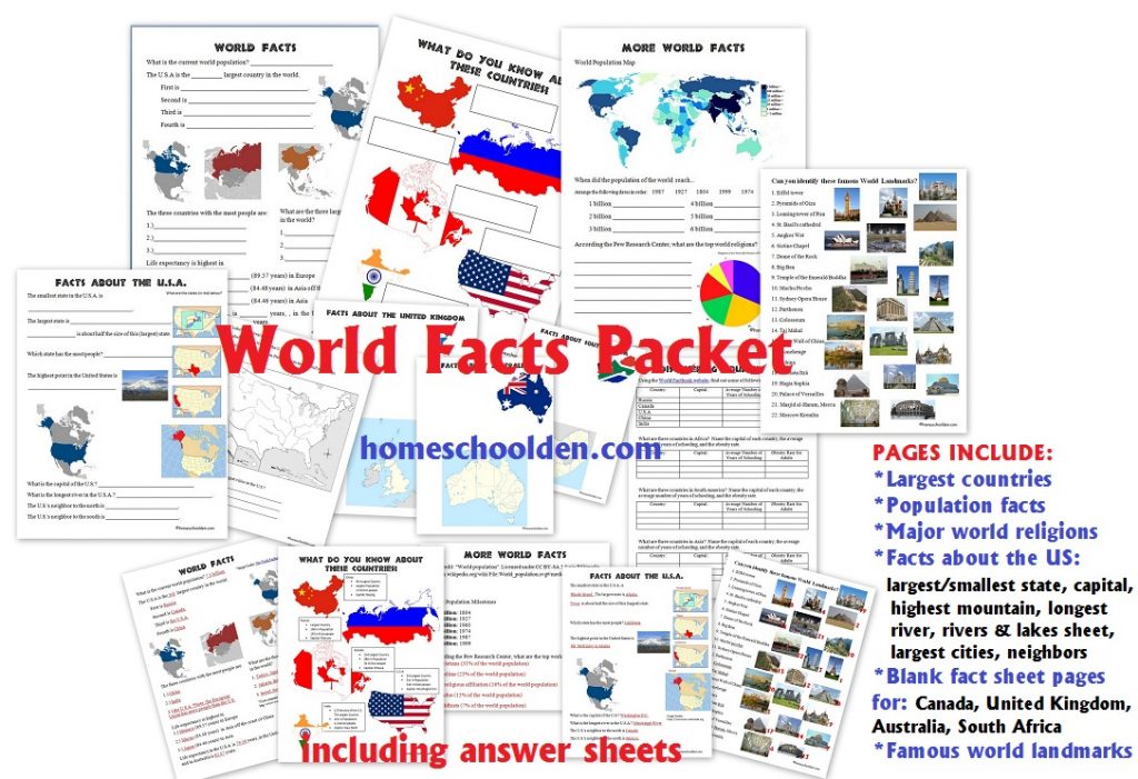
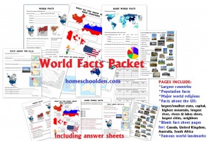
![]() $6.99 World Facts Packet 70+ pages (Find out more here at this post)
$6.99 World Facts Packet 70+ pages (Find out more here at this post)
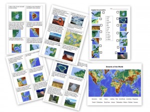
We often start the new semester reviewing basic world facts like the largest countries, the countries with the most people, the largest cities, longest rivers, highest mountains, famous world landmarks, basic geography terms like peninsula, atoll, and archipelago, deserts of the world, and more!

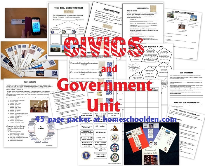
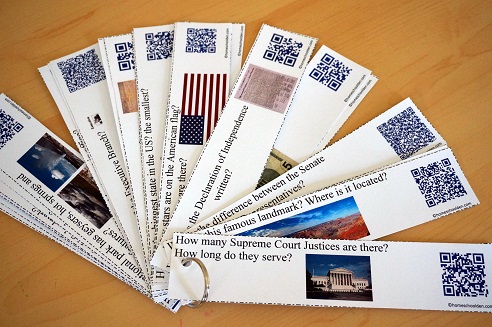
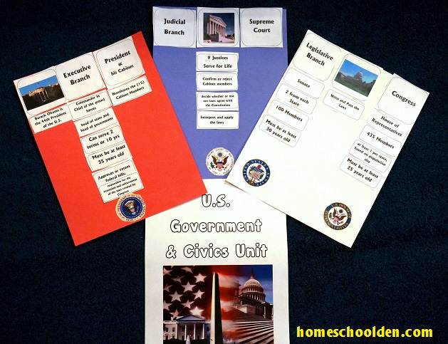
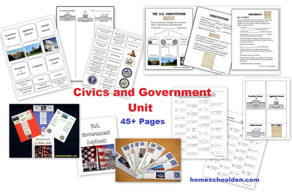
![]() $5.99 Civics and Government Packet
$5.99 Civics and Government Packet
This packet goes over some basic facts about the U.S. It covers the three branches of government, the US cabinet, the difference between federal and state governments as well as basic information about the US (what is the liberty bell, when was the Declaration of Independence written, and things like that).
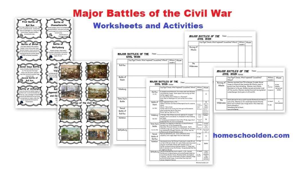
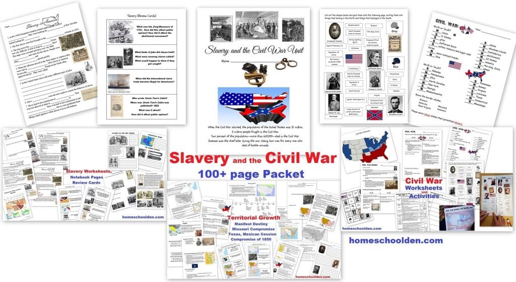
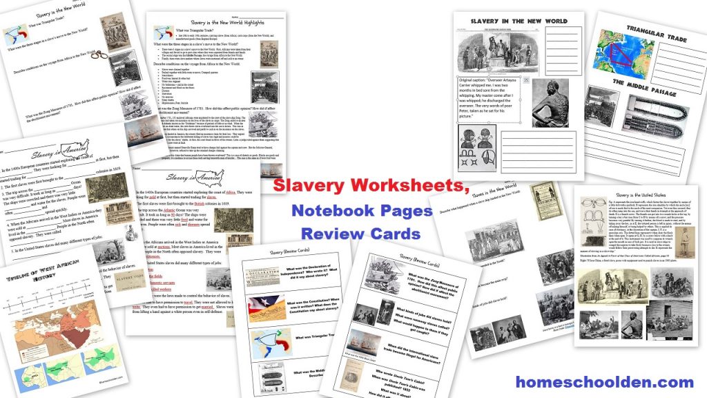
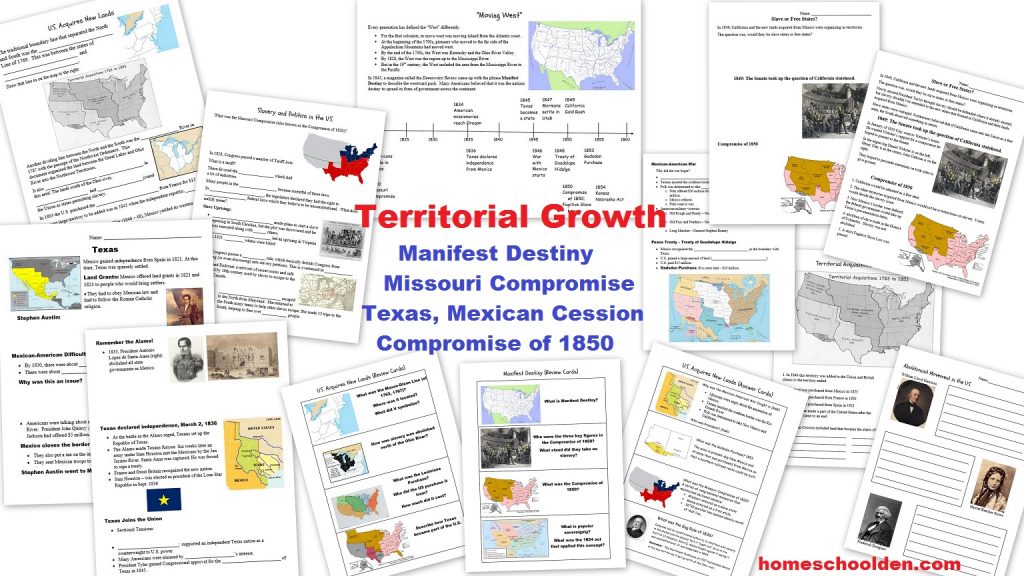
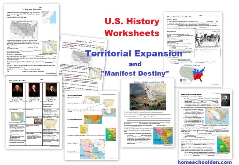
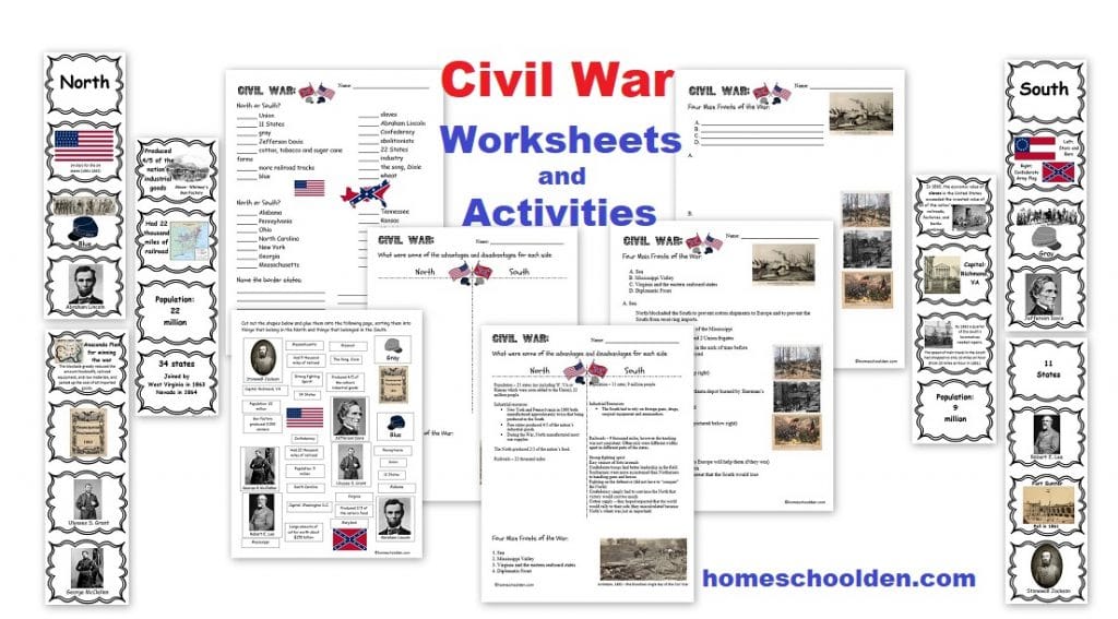
![]() $7.99 Slavery and the Civil War (100 pages – slavery, U.S. territorial expansion, the Civil War) (See more details here) or view image 1, image 2, image 3, image 4, image 5, image 6, image 7, image 8
$7.99 Slavery and the Civil War (100 pages – slavery, U.S. territorial expansion, the Civil War) (See more details here) or view image 1, image 2, image 3, image 4, image 5, image 6, image 7, image 8

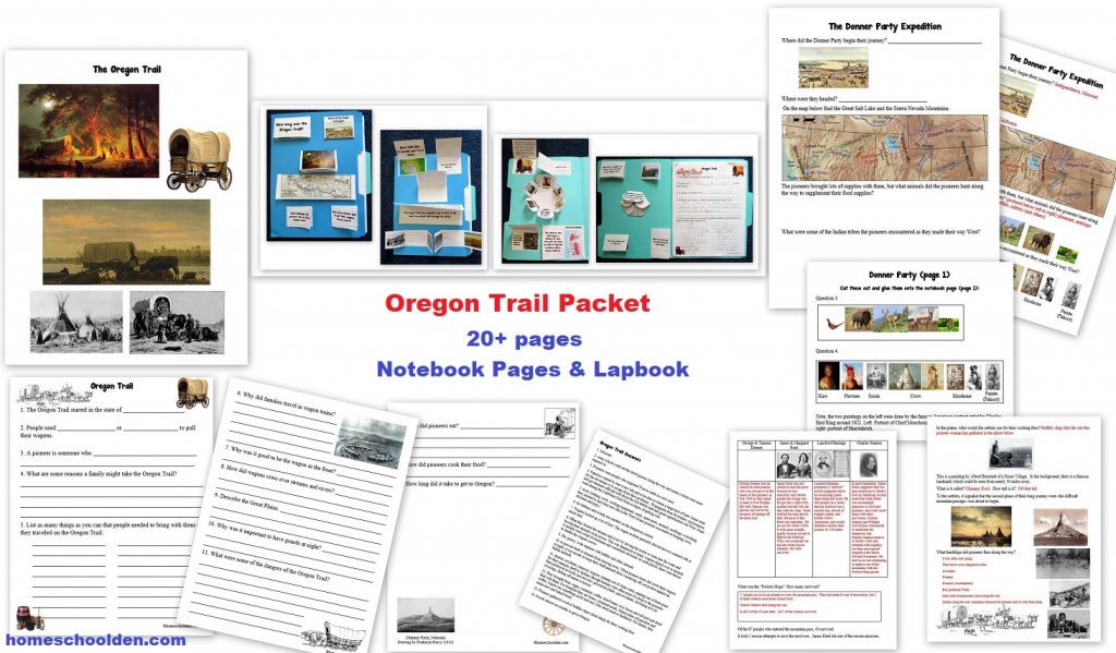
![]() $4.99 Oregon Trail Packet Quick Preview or visit the post or view image
$4.99 Oregon Trail Packet Quick Preview or visit the post or view image
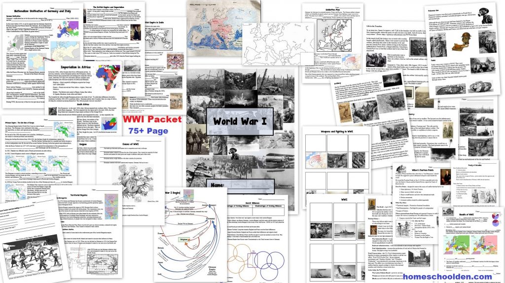
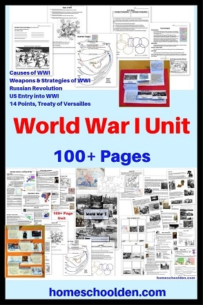
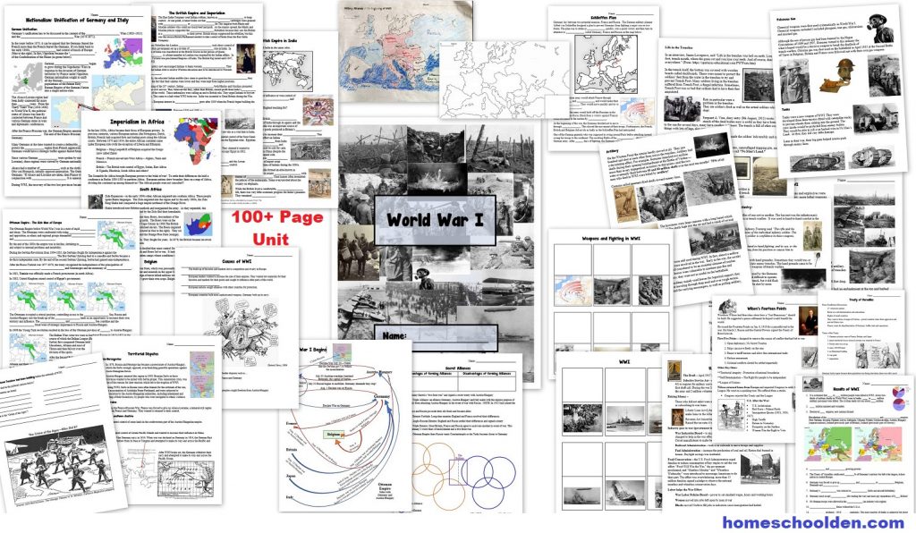
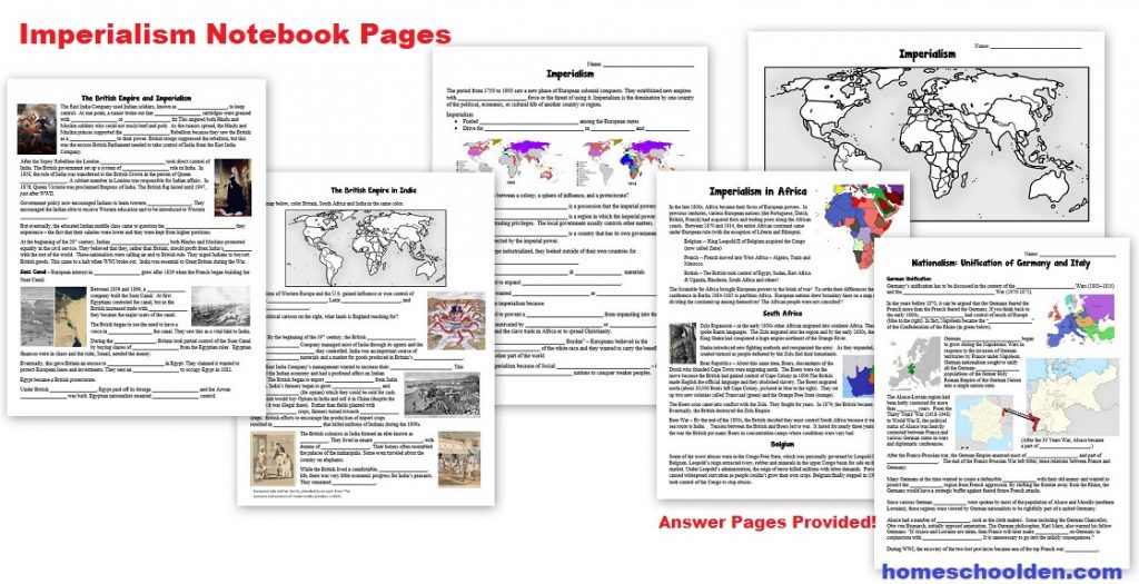
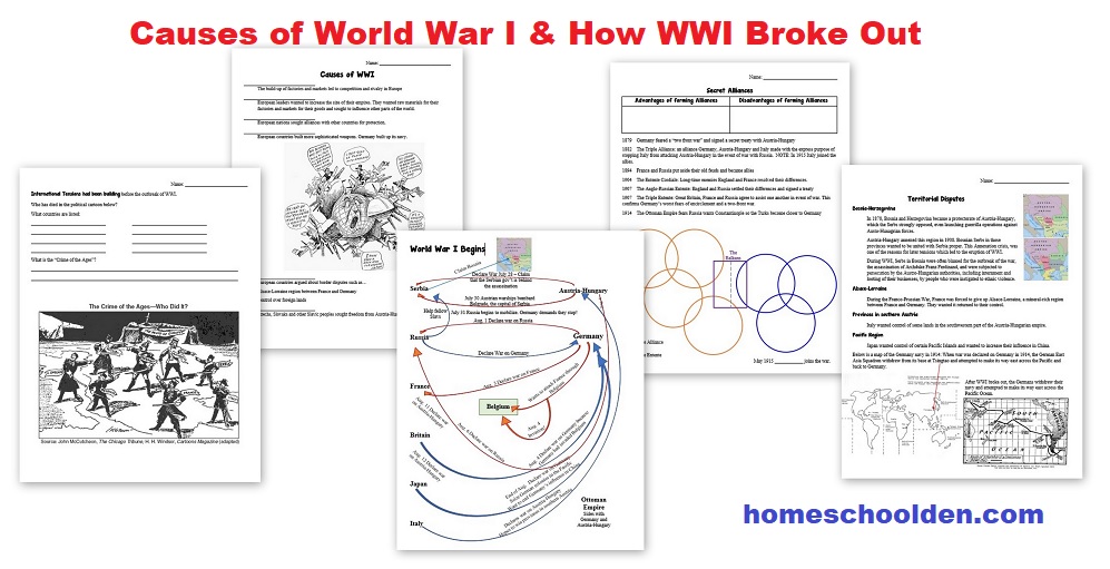
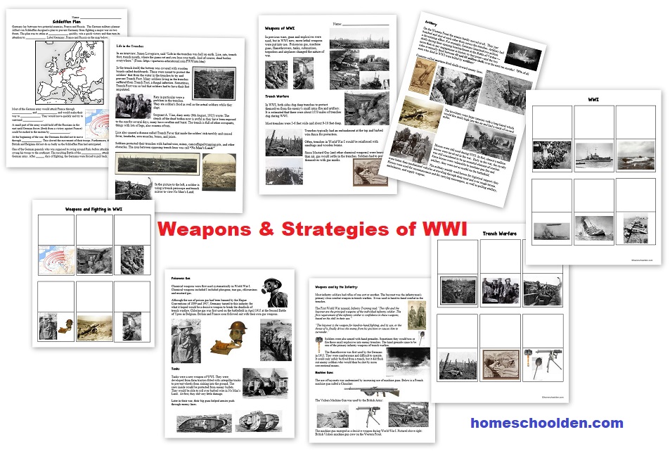
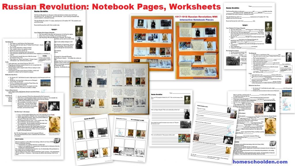
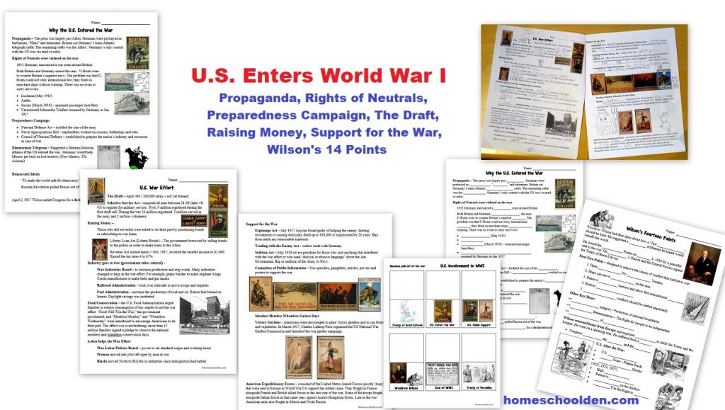
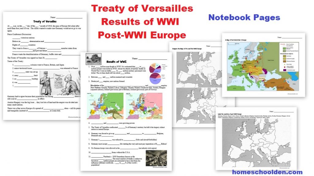
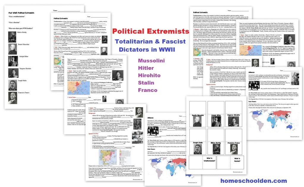
![]() $9.99 World War I Packet 100+ pages World War I – Quick Preview or visit the post or view image 1, image 2, image 3, image 4, image 5, image 6, image 7
$9.99 World War I Packet 100+ pages World War I – Quick Preview or visit the post or view image 1, image 2, image 3, image 4, image 5, image 6, image 7
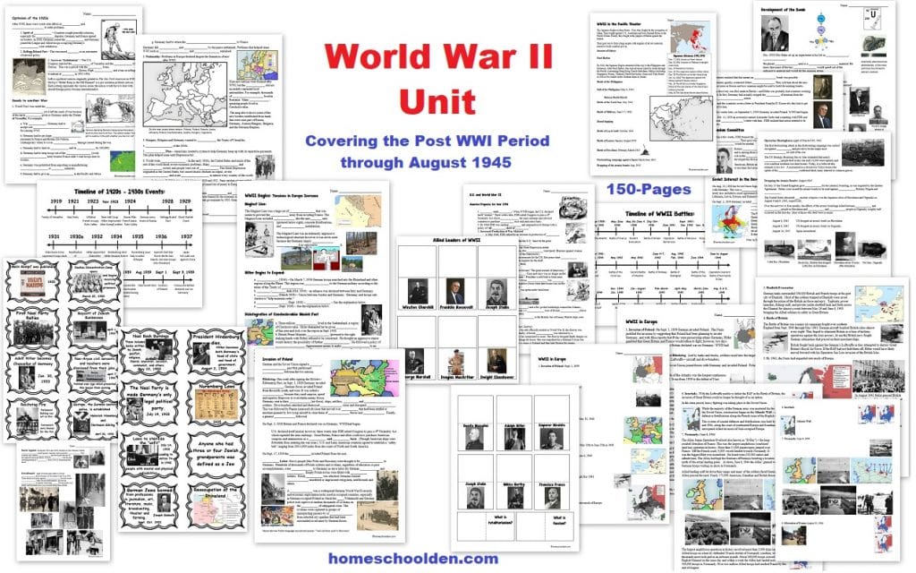
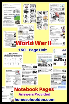
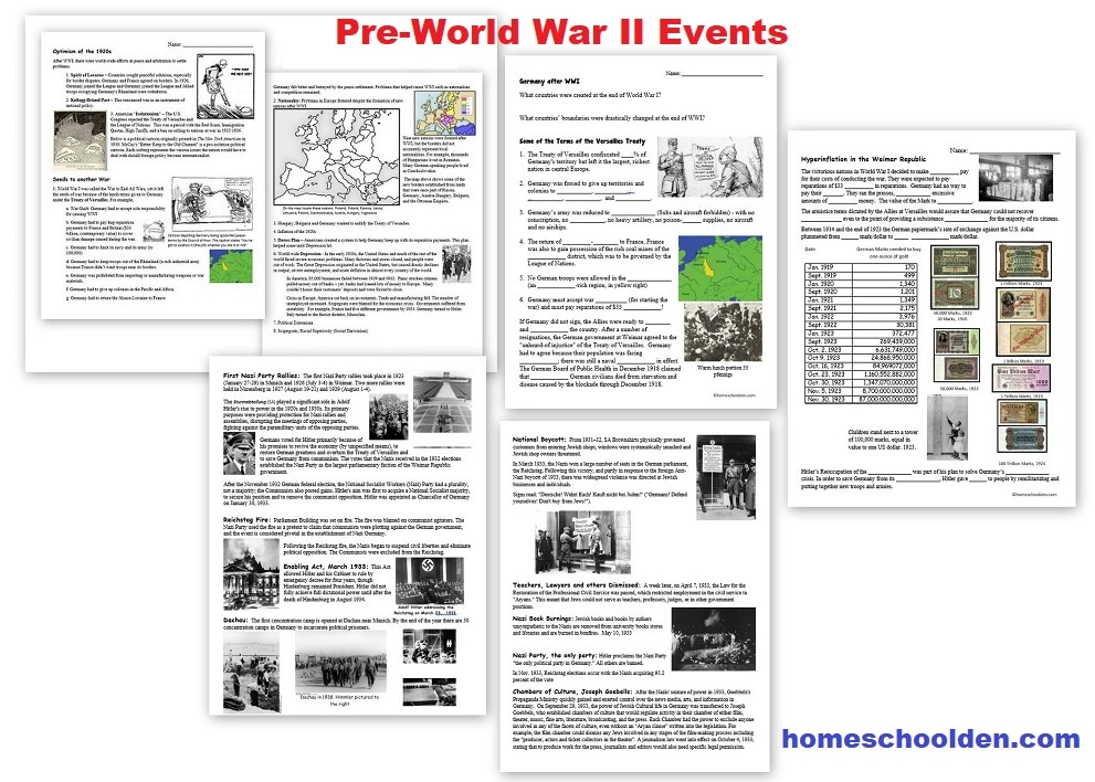
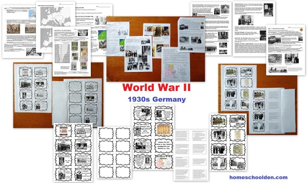
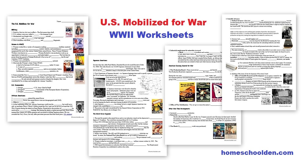
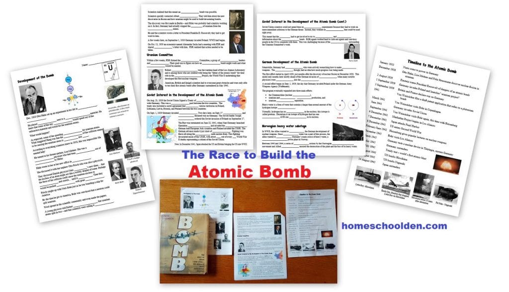
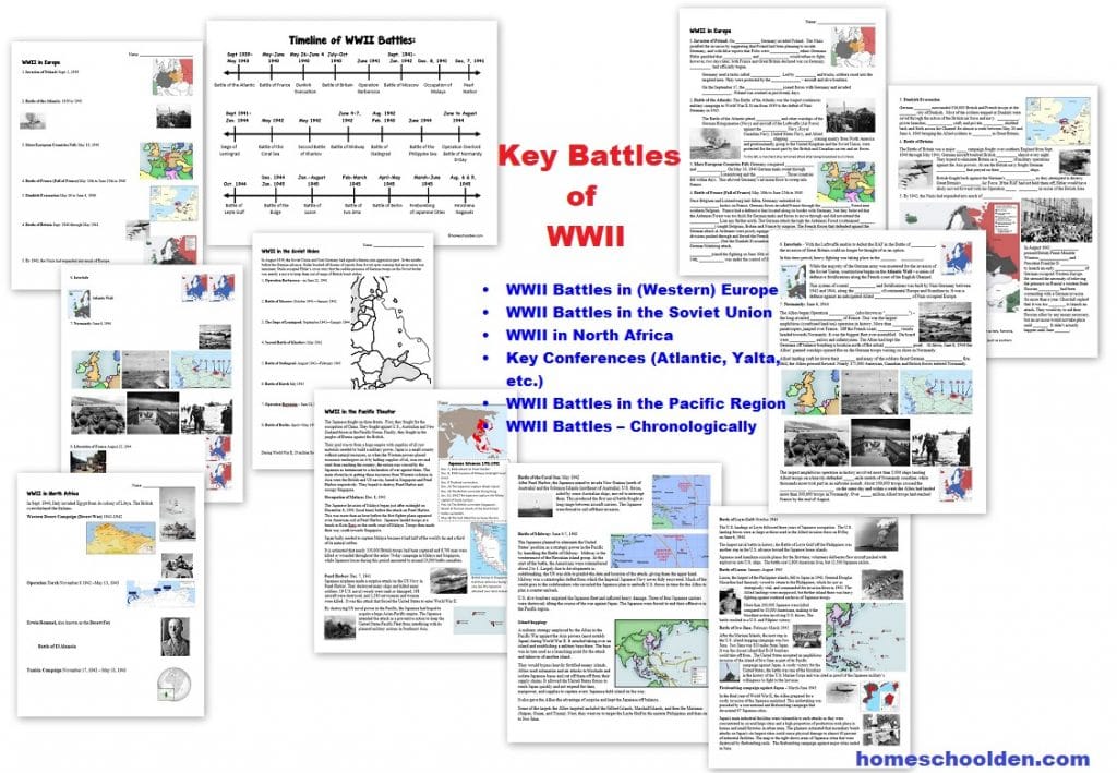
![]() $9.99 World War II Unit (150 pages) from the post WWI period through Aug. 1945. Visit the post for more details. View image 1, image 2, image 3, image 4, image 5, image 6, image 7
$9.99 World War II Unit (150 pages) from the post WWI period through Aug. 1945. Visit the post for more details. View image 1, image 2, image 3, image 4, image 5, image 6, image 7
 Find out more about our history packets at our history units page
Visit Our Store if you are interested in checking out some of our other packets.Don’t forget to check your PayPal email address for the download link.

To find out more about our Privacy Policy, click here.
See you again soon here or over at our Homeschool Den Facebook Page! You might also want to check out some of our resources pages above (such as our Science, Language Arts, or History Units Resource Pages) which have links to dozens of posts. You might want to join our free Homeschool Den Chat Facebook group. Don’t forget to check out Our Store as well. ![]()
 Again, you can click here to Subscribe to our Homeschool Den Newsletter!

Happy Homeschooling, everyone!! ~Liesl


